|
search place name
|
||
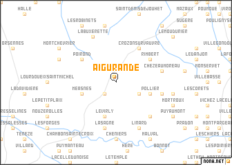
Aigurande (Centre, France)Aigurande is a town in the Centre region of France. An overview map of the region around Aigurande is displayed below.
regional and 3d topo map of Aigurande, France ::
Aigurande airports ::
The nearest airport is MCU - Montlucon-gueret Montlucon Gueret, located 47.1 km south east of Aigurande.
Other airports nearby include CHR - Chateauroux Deols (48.3 km north), MCU - Montlucon Domerat (57.4 km east), BOU - Bourges (80.7 km north east), LIG - Limoges Bellegarde (81.1 km south west), Nearby towns ::
Lourdoueix-Saint-Pierre (2.3km south west) //
Beauregard (3.2km south east) //
Méasnes (4.3km south west) //
Pollier (4.3km south east) //
Le Virly (5.7km south) //
Crozon-sur-Vauvre (6.1km north east) //
Poirond (5.3km north west) //
Rimbert (5.3km north east) //
La Sagne (7.5km south) //
La Forêt-du-Temple (5.4km east) //
Chézeau Moreau (5.4km east) //
Laiguillon (6.8km south east) //
Linard (7.8km south) //
La Buxerette (7.8km north) //
[all distances 'as the bird flies' and approximate] 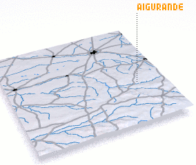 Places with similar names to Aigurande, France ::
// Aguairenda (BO)
// Aguayrenda (BO)
// Akrūnt (OM)
// Acuirindi (MZ)
// Akrounda (CY)
// Agrant (PG)
// Akrund (IN)
Disclaimer :: Information on this page comes without warranty of any kind |
||
|
Where is Aigurande? Elevation and coordinates ::
Latitude (lat): 46°26'0"N Longitude (lon): 1°50'0"E
Elevation (approx.): 429m (map arrows pan, magnifying glasses zoom) |
||
|
Visiting Aigurande? Hotel/Accommodation ::
Book a hotel in Aigurande Travel Guide ::
Buy a travel guide for France rental cars ::
car rental offers GPS waypoint ::
download a GPX waypoint (PoI) of Aigurande for your GPS receiver
|
||