|
search place name
|
||
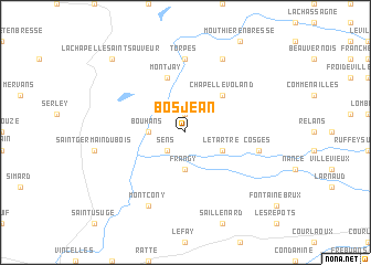
Bosjean (Bourgogne, France)Bosjean is a town in the Bourgogne region of France. An overview map of the region around Bosjean is displayed below.
regional and 3d topo map of Bosjean, France ::
Bosjean airports ::
The nearest airport is DLE - Dole Tavaux, located 31.1 km north of Bosjean.
Other airports nearby include XCD - Chalon Champforgeuil (39.9 km west), DIJ - Dijon Longvic (58.8 km north), XBK - Bourg Ceyzeriat (63.0 km south), QNX - Macon Charnay (66.7 km south west), Nearby towns ::
Le Planois (1.9km north) //
Sens (2.2km south west) //
Bouhans (2.5km west) //
Frangy (3.7km south) //
Le Tartre (3.1km south east) //
Chapelle-Voland (4.5km north east) //
Montjay (5.7km north) //
Torpes (7.4km north) //
Cosges (5.4km east) //
Bellevesvre (7.8km north) //
Montcony (7.8km south) //
La Chaux (9.0km north west) //
La Chapelle-Saint-Sauveur (9.0km north west) //
[all distances 'as the bird flies' and approximate] 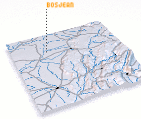 Places with similar names to Bosjean, France ::
// Bezujno (BA)
// Busygino (RU)
// Bīzjān (IR)
// Bozījān (IR)
// Būsjīn (IR)
// Bisigen (BF)
// Bois Jaune (HT)
// Bois Jaune (HT)
// Bois Jeanay (HT)
// Bois-Jean (FR)
Disclaimer :: Information on this page comes without warranty of any kind |
||
|
Where is Bosjean? Elevation and coordinates ::
Latitude (lat): 46°46'0"N Longitude (lon): 5°20'0"E
Elevation (approx.): 193m (map arrows pan, magnifying glasses zoom) |
||
|
Visiting Bosjean? Hotel/Accommodation ::
Book a hotel in Bosjean Travel Guide ::
Buy a travel guide for France rental cars ::
car rental offers GPS waypoint ::
download a GPX waypoint (PoI) of Bosjean for your GPS receiver
|
||