|
search place name
|
||
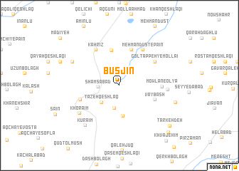
Būsjīn (Iran)Būsjīn is a town in Iran. An overview map of the region around Būsjīn is displayed below.
regional and 3d topo map of Būsjīn, Iran ::
Būsjīn airports ::
The nearest airport is RAS - Rasht, located 138.6 km south east of Būsjīn.
Nearby towns ::
Shamsābād (2.7km west) //
Jīn Qeshlāq (3.6km south) //
Tāzeh Qeshlāq (3.4km south west) //
Tājībeyūk (4.8km south) //
Havā Daraq (5.5km north) //
Mehmāndūst-e Bālā (5.7km north) //
Vāybāsh (5.0km south east) //
Ḩājjī Maḩmūd (5.3km south west) //
Mowlān-e ‘Olyā (5.3km east) //
Gol Tappeh-ye Mollā'ī (5.7km north east) //
Chanz̄āb (6.3km north west) //
Kahrīz (6.3km north west) //
Mehmāndūst-e Pā'īn (6.3km north east) //
Mowlān-e Soflá (6.0km east) //
Khorā'īm (6.6km south west) //
Kūrā'īm (7.6km south west) //
Īncheh (6.9km north west) //
Pīlah Galīn (7.5km east) //
Tarkeh Deh (8.9km south east) //
Narlū (9.5km south east) //
Khvājehīm (10.5km south east) //
[all distances 'as the bird flies' and approximate]  Places with similar names to Būsjīn, Iran ::
// Bezujno (BA)
// Busygino (RU)
// Bīzjān (IR)
// Bozījān (IR)
// Bisigen (BF)
// Bois Jaune (HT)
// Bois Jaune (HT)
// Bois Jeanay (HT)
// Bosjean (FR)
// Bois-Jean (FR)
Disclaimer :: Information on this page comes without warranty of any kind |
||
|
Where is Būsjīn? Elevation and coordinates ::
Latitude (lat): 38°0'0"N Longitude (lon): 48°17'0"E
Elevation (approx.): 1473m (map arrows pan, magnifying glasses zoom) |
||
|
Visiting Būsjīn? Hotel/Accommodation ::
Book a hotel in Būsjīn Travel Guide ::
Buy a travel guide for Iran rental cars ::
car rental offers GPS waypoint ::
download a GPX waypoint (PoI) of Būsjīn for your GPS receiver
|
||