|
search place name
|
||
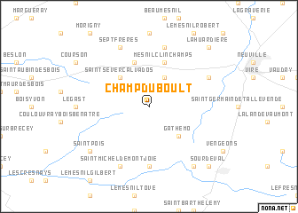
Champ-du-Boult (Basse-Normandie, France)Champ-du-Boult is a town in the Basse-Normandie region of France. An overview map of the region around Champ-du-Boult is displayed below.
regional and 3d topo map of Champ-du-Boult, France ::
Champ-du-Boult airports ::
The nearest airport is CFR - Caen Carpiquet, located 57.8 km north east of Champ-du-Boult.
Other airports nearby include DNR - Dinard Pleurtuit (82.9 km west), LVA - Laval Entrammes (87.6 km south), RNS - Rennes St Jacques (97.7 km south west), JER - Jersey (98.5 km north west), Nearby towns ::
Saint-Manvieu-Bocage (3.9km north) //
Gathemo (4.4km south east) //
Saint-Sever-Calvados (4.4km north west) //
Le Mesnil-Caussois (5.7km north) //
Mesnil-Clinchamps (5.7km north) //
Perriers-en-Beauficel (7.4km south) //
Le Mesnil-Benoist (7.5km north) //
Saint-Michel-de-Montjoie (7.8km south) //
Lingeard (7.8km south) //
Saint-Martin-de-Tallevende (6.1km north east) //
Sept-Frères (7.8km north) //
Saint-Pois (7.4km south west) //
Beauficel (8.3km south east) //
Sourdeval (8.9km south east) //
La Huardière (8.9km north east) //
[all distances 'as the bird flies' and approximate]  Places with similar names to Champ-du-Boult, France :: Disclaimer :: Information on this page comes without warranty of any kind |
||
|
Where is Champ-du-Boult? Elevation and coordinates ::
Latitude (lat): 48°48'0"N Longitude (lon): 1°0'0"W
Elevation (approx.): 290m (map arrows pan, magnifying glasses zoom) |
||
|
Visiting Champ-du-Boult? Hotel/Accommodation ::
Book a hotel in Champ-du-Boult Travel Guide ::
Buy a travel guide for France rental cars ::
car rental offers GPS waypoint ::
download a GPX waypoint (PoI) of Champ-du-Boult for your GPS receiver
|
||