|
search place name
|
||
Donzère (Rhône-Alpes, France)Donzère is a town in the Rhône-Alpes region of France. An overview map of the region around Donzère is displayed below.
regional and 3d topo map of Donzère, France ::

Donzère airports ::
The nearest airport is OBS - Aubenas-vals-lanas Ardeche Meridionale, located 29.3 km west of Donzère.
Other airports nearby include VAF - Valence Chabeuil (56.1 km north), AVN - Avignon Caumont (62.1 km south), FNI - Nimes Garons (80.6 km south), MEN - Mende Brenoux (94.4 km west), Nearby towns ::
Châteauneuf-du-Rhône (3.7km north) //
Malataverne (4.6km north east) //
Le Logis de Berre (4.6km south east) //
Viviers (4.6km north west) //
Les Granges-Gontardes (5.4km south east) //
La Garde-Adhémar (6.2km south east) //
La Moutte (6.2km north west) //
Pierrelatte (7.5km south) //
Allan (6.5km north east) //
[all distances 'as the bird flies' and approximate] 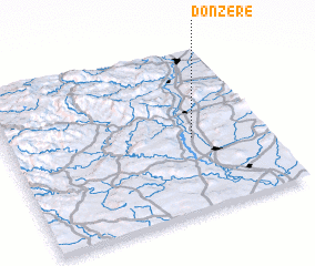 Places with similar names to Donzère, France ::
// Tanessar (MA)
// Da-an Sur (PH)
// Dinosaur (US)
// Duna Sor (HU)
// Tõnissaare (EE)
// Danışır (TR)
// Dansür (TR)
// Dansar (IR)
// Deh Naz̄rī (IR)
// Dīneh Sar (IR)
Disclaimer :: Information on this page comes without warranty of any kind |
||
|
Where is Donzère? Elevation and coordinates ::
Latitude (lat): 44°27'0"N Longitude (lon): 4°43'0"E
Elevation (approx.): 109m (map arrows pan, magnifying glasses zoom) |
||
|
Visiting Donzère? Hotel/Accommodation ::
Book a hotel in Donzère Travel Guide ::
Buy a travel guide for France rental cars ::
car rental offers GPS waypoint ::
download a GPX waypoint (PoI) of Donzère for your GPS receiver
|
||