|
search place name
|
||
Alvares (Beja, Portugal)Alvares is a town in the Beja region of Portugal. An overview map of the region around Alvares is displayed below.
regional and 3d topo map of Alvares, Portugal ::

Alvares airports ::
The nearest airport is FAO - Faro, located 73.9 km south of Alvares.
Other airports nearby include BJZ - Badajoz Talavera La Real (160.7 km north east), LIS - Lisbon Lisboa (170.3 km north west), SVQ - Sevilla (170.8 km east), XRY - Jerez (185.3 km south east), Nearby towns ::
Meceares (2.4km north west) //
João Serra (3.5km north west) //
Corte de Pão e Água (3.5km south east) //
Alcaria Ruiva (4.0km north) //
São João dos Caldeireiros (5.6km south) //
Corte da Velha (4.8km north east) //
Aipo (4.8km north west) //
Penilhos (4.8km south west) //
Bemviúda (6.3km north west) //
Trafeiras (6.3km north east) //
Martinhanes (5.8km south west) //
Simões (7.6km south) //
Tacões (6.2km west) //
A de Lede (7.1km south east) //
Vasco Rodrigues (8.0km south) //
Morena (6.9km south east) //
Brites Gomes (8.1km south east) //
[all distances 'as the bird flies' and approximate] 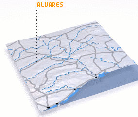 Places with similar names to Alvares, Portugal ::
Disclaimer :: Information on this page comes without warranty of any kind |
||
|
Where is Alvares? Elevation and coordinates ::
Latitude (lat): 37°40'0"N Longitude (lon): 7°48'0"W
Elevation (approx.): 136m (map arrows pan, magnifying glasses zoom) |
||
|
Visiting Alvares? Hotel/Accommodation ::
Book a hotel in Alvares Travel Guide ::
Buy a travel guide for Portugal rental cars ::
car rental offers GPS waypoint ::
download a GPX waypoint (PoI) of Alvares for your GPS receiver
|
||