|
search place name
|
||
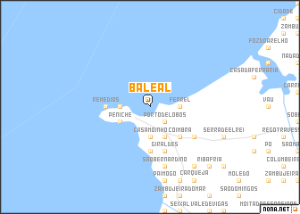
Baleal (Leiria, Portugal)Baleal is a town in the Leiria region of Portugal. An overview map of the region around Baleal is displayed below.
regional and 3d topo map of Baleal, Portugal ::
Baleal airports ::
The nearest airport is LIS - Lisbon Lisboa, located 67.6 km south of Baleal.
Other airports nearby include OPO - Porto (216.5 km north), VRL - Vila Real (253.1 km north east), Nearby towns ::
Porto de Lobos (2.3km south east) //
Ferrel (2.9km east) //
Peniche de Cima (2.9km west) //
Casa Moinho (3.7km south) //
Peniche (3.4km south west) //
Atouguia da Baleia (4.0km south) //
Coimbrã (4.7km south east) //
Remédios (4.3km west) //
Consolação (5.6km south) //
Giraldes (5.7km south) //
Estrada (5.7km south) //
Fetais (5.7km south east) //
Casais Brancos (5.7km south east) //
Reinaldos (5.7km south east) //
São Bernardino (7.6km south) //
Bufarda (8.6km south east) //
Bolhos (9.4km south east) //
Carnide (9.4km south east) //
Riba Fria (9.4km south east) //
Paço (9.4km south east) //
[all distances 'as the bird flies' and approximate]  Places with similar names to Baleal, Portugal ::
Disclaimer :: Information on this page comes without warranty of any kind |
||
|
Where is Baleal? Elevation and coordinates ::
Latitude (lat): 39°22'0"N Longitude (lon): 9°21'0"W
Elevation (approx.): -32768m (map arrows pan, magnifying glasses zoom) |
||
|
Visiting Baleal? Hotel/Accommodation ::
Book a hotel in Baleal Travel Guide ::
Buy a travel guide for Portugal rental cars ::
car rental offers GPS waypoint ::
download a GPX waypoint (PoI) of Baleal for your GPS receiver
|
||