|
search place name
|
||
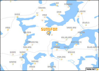
Sundfør (Rogaland, Norway)Sundfør is a town in the Rogaland region of Norway. An overview map of the region around Sundfør is displayed below.
regional and 3d topo map of Sundfør, Norway ::
Sundfør airports ::
The nearest airport is HAU - Haugesund Karmoy, located 20.7 km south west of Sundfør.
Other airports nearby include SRP - Stord Sorstokken (35.3 km north), SVG - Stavanger Sola (68.1 km south), BGO - Bergen Flesland (91.5 km north), FAN - Lista (168.1 km south east), Nearby towns ::
Glette (0.5km north east) //
Våg (3.7km south) //
Grinde (5.5km south) //
Kvalvåg (5.8km north) //
Kalvaland (3.7km south east) //
Våge (7.0km north) //
Stakkastad (4.8km south west) //
Halseid (4.2km west) //
Søvik (6.3km south east) //
Dagsland (4.7km north east) //
Erve (8.2km north) //
Li (8.0km north) //
Nodland (6.8km south west) //
Brekke (8.3km south east) //
[all distances 'as the bird flies' and approximate]  Places with similar names to Sundfør, Norway ::
// Centovera (IT)
// Santo Varão (PT)
// Sendvariai (LT)
// Sendvariai (LT)
// Santaveri (IN)
// Santafara (ML)
// Santa Fiora (IT)
// Saint-Avre (FR)
// Sainte-Feyre (FR)
// Saint-Vaury (FR)
Disclaimer :: Information on this page comes without warranty of any kind |
||
|
Where is Sundfør? Elevation and coordinates ::
Latitude (lat): 59°28'52"N Longitude (lon): 5°27'30"E
Elevation (approx.): 36m (map arrows pan, magnifying glasses zoom) |
||
|
Visiting Sundfør? Hotel/Accommodation ::
Book a hotel in Sundfør Travel Guide ::
Buy a travel guide for Norway rental cars ::
car rental offers GPS waypoint ::
download a GPX waypoint (PoI) of Sundfør for your GPS receiver
|
||