|
search place name
|
||
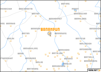
Ban Ampun (Thailand)Ban Ampun is a town in Thailand. An overview map of the region around Ban Ampun is displayed below.
regional and 3d topo map of Ban Ampun, Thailand ::
Ban Ampun airports ::
The nearest airport is REP - Siem-reap Siem Reap, located 137.0 km south east of Ban Ampun.
Other airports nearby include NAK - Nakhon Ratchasima Khorat (139.9 km west), Nearby towns ::
Amphoe Prasat (0.0km north) //
Ban Mamiang (1.8km east) //
Ban Ran Deng (3.6km east) //
Ban Khok Phet (5.8km north) //
Ban An Sam (5.7km west) //
Ban Khok Krom (6.1km south east) //
Ban Khok Marum (6.3km south) //
Ban Chik Daek (7.1km south) //
Ban Sai Kulap (7.5km south) //
Ban Ta Luak (7.7km south) //
Ban Nikhom 3 (7.8km south east) //
Ban Si Samphan (7.9km south) //
Ban Bak Dok (8.2km north west) //
Ban Nong Ra-Ang (8.4km south east) //
Ban Tani (9.2km north west) //
Ban Khok Klang (9.1km south west) //
Ban Nong Waeng (9.3km south east) //
Ban Nong Waeng (9.9km south east) //
Ban Nikhom 2 (10.9km south east) //
[all distances 'as the bird flies' and approximate] 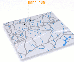 Places with similar names to Ban Ampun, Thailand ::
// Ban Ampuen (TH)
// Ban Ampun (TH)
// Ban Ampun (TH)
// Ban Ampun (TH)
// Ban Mae Aep Nai (TH)
// Ban Mae Paen (TH)
// Ban Mae Pan (TH)
// Ban Mae Pan (TH)
// Ban Mae Pan (TH)
// Ban Mae Pan Noi (TH)
Disclaimer :: Information on this page comes without warranty of any kind |
||
|
Where is Ban Ampun? Elevation and coordinates ::
Latitude (lat): 14°33'0"N Longitude (lon): 103°19'0"E
Elevation (approx.): 168m (map arrows pan, magnifying glasses zoom) |
||
|
Visiting Ban Ampun? Hotel/Accommodation ::
Book a hotel in Ban Ampun Travel Guide ::
Buy a travel guide for Thailand rental cars ::
car rental offers GPS waypoint ::
download a GPX waypoint (PoI) of Ban Ampun for your GPS receiver
|
||