|
search place name
|
||
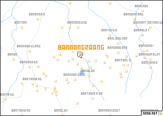
Ban Nong Ra-Ang (Surin, Thailand)Ban Nong Ra-Ang is a town in the Surin region of Thailand. An overview map of the region around Ban Nong Ra-Ang is displayed below.
regional and 3d topo map of Ban Nong Ra-Ang, Thailand ::
Ban Nong Ra-Ang airports ::
The nearest airport is REP - Siem-reap Siem Reap, located 128.7 km south of Ban Nong Ra-Ang.
Other airports nearby include NAK - Nakhon Ratchasima Khorat (146.4 km west), Nearby towns ::
Ban Nikhom 3 (1.2km north) //
Ban Nong Waeng (1.7km south west) //
Ban Nong Waeng (1.8km south east) //
Ban Ta Luak (2.0km west) //
Ban Nong Raet (2.3km south) //
Ban Khok Krom (2.5km north west) //
Ban Sako (2.9km south east) //
Ban Si Samphan (2.9km west) //
Ban Nikhom 2 (3.3km east) //
Ban U Lok (4.4km south) //
Ban Khok Marum (4.9km west) //
Ban Khok Sung (5.2km south) //
Ban Khlong Charoen (5.3km east) //
Ban Sai Kulap (5.4km west) //
Ban Chan Hom (5.5km east) //
Ban Khok Phayung (5.8km east) //
Ban Khok Raka (6.0km south west) //
Ban Ampuen (6.4km south west) //
Ban Chik Daek (6.2km west) //
Ban Khu (6.7km east) //
Ban Na Phun (6.9km south) //
Ban Chang Mop Phatthana (7.0km south east) //
Ban Ran Deng (7.2km north) //
Ban Mamiang (7.6km north) //
Ban Phanom Dong Rak (7.8km south west) //
Ban Ta Yua (8.3km north east) //
Amphoe Prasat (8.4km north west) //
Ban Ampun (8.4km north west) //
Ban Sa Boran (8.3km east) //
[all distances 'as the bird flies' and approximate]  Places with similar names to Ban Nong Ra-Ang, Thailand ::
// Banuang Gurang (PH)
// Ban Nong Rang (TH)
// Ban Nong Rang (TH)
// Ban Nong Rang (TH)
// Ban Nong Riang (TH)
// Ban Nong Rong (TH)
// Ban Nong Rong (TH)
// Ban Nong Rong (TH)
// Ban Nong Rong (TH)
// Ban Nong Rong (TH)
Disclaimer :: Information on this page comes without warranty of any kind |
||
|
Where is Ban Nong Ra-Ang? Elevation and coordinates ::
Latitude (lat): 14°29'9"N Longitude (lon): 103°21'28"E
Elevation (approx.): 183m (map arrows pan, magnifying glasses zoom) |
||
|
Visiting Ban Nong Ra-Ang? Hotel/Accommodation ::
Book a hotel in Ban Nong Ra-Ang Travel Guide ::
Buy a travel guide for Thailand rental cars ::
car rental offers GPS waypoint ::
download a GPX waypoint (PoI) of Ban Nong Ra-Ang for your GPS receiver
|
||