|
search place name
|
||
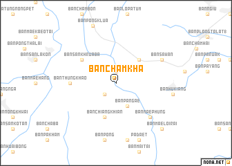
Ban Cham Kha (Chiang Rai, Thailand)Ban Cham Kha is a town in the Chiang Rai region of Thailand. An overview map of the region around Ban Cham Kha is displayed below.
regional and 3d topo map of Ban Cham Kha, Thailand ::
Ban Cham Kha airports ::
The nearest airport is THL - Tachilek Tachileik, located 99.7 km north of Ban Cham Kha.
Other airports nearby include MOG - Mong Hsat (127.2 km north west), LPT - Lampang (153.2 km south), PRH - Phrae (162.0 km south), KET - Kengtung (193.3 km north), Nearby towns ::
Ban San Saraphi (1.9km north) //
Ban Mae Sun (2.5km south west) //
Ban Pa Ngae (4.1km south east) //
Ban Chiang Khian (5.1km north east) //
Ban Chiang Khian (5.8km south) //
Ban San Khrua Ba (6.4km north west) //
Ban Thung Khao (7.0km west) //
Ban Mae Phung (7.6km south east) //
Ban Plong Talat (7.9km north east) //
Ban Sawan (7.9km north east) //
Ban Cham Hai (7.9km north east) //
Ban Mae Loi Rai (10.2km south east) //
[all distances 'as the bird flies' and approximate] 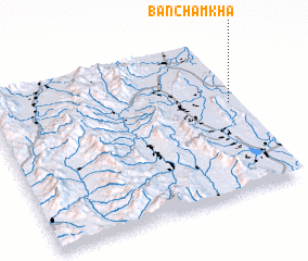 Places with similar names to Ban Cham Kha, Thailand ::
// Ban Cha Makha (TH)
// Ban Cham Kha (TH)
// Ban Cha Mu Kha (TH)
// Ban Chum Kho (TH)
// Ban Chomkha (LA)
Disclaimer :: Information on this page comes without warranty of any kind |
||
|
Where is Ban Cham Kha? Elevation and coordinates ::
Latitude (lat): 19°35'0"N Longitude (lon): 99°58'0"E
Elevation (approx.): 389m (map arrows pan, magnifying glasses zoom) |
||
|
Visiting Ban Cham Kha? Hotel/Accommodation ::
Book a hotel in Ban Cham Kha Travel Guide ::
Buy a travel guide for Thailand rental cars ::
car rental offers GPS waypoint ::
download a GPX waypoint (PoI) of Ban Cham Kha for your GPS receiver
|
||