|
search place name
|
||
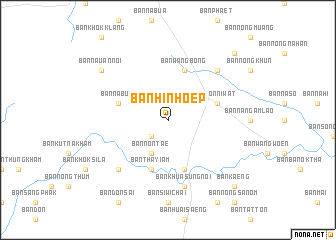
Ban Hin Hoep (Sakon Nakhon, Thailand)Ban Hin Hoep is a town in the Sakon Nakhon region of Thailand. An overview map of the region around Ban Hin Hoep is displayed below.
regional and 3d topo map of Ban Hin Hoep, Thailand ::
Ban Hin Hoep airports ::
The nearest airport is SNO - Sakon Nakhon, located 63.2 km south east of Ban Hin Hoep.
Other airports nearby include UTH - Udon Thani (101.8 km west), VTE - Vientiane Wattay Intl (129.0 km west), ZVK - Savannakhet (161.5 km south east), LOE - Loei (212.7 km west), Nearby towns ::
Ban Tan Dieo (2.6km south west) //
Ban Non Tae (4.1km south west) //
Wanon Niwat (5.6km east) //
Ban Don Ya Nang (5.6km east) //
Ban Wang Bong (5.8km north) //
Ban Don Sai (5.8km south) //
Amphoe Wanon Niwat (5.6km west) //
Ban Don Mui (5.6km west) //
Ban Na Bua (5.6km west) //
Ban Tha Yiam (5.8km south) //
Ban Don Daeng (5.8km south) //
Ban Khua Sung Noi (7.6km south) //
Ban Khua Sung (7.6km south) //
Ban Don Mui (7.7km north east) //
Ban Kham Bon (7.7km south west) //
Ban Na Uan Noi (9.0km north west) //
Ban Nong Faek (10.2km north east) //
Ban Kaeng (10.2km south east) //
[all distances 'as the bird flies' and approximate] 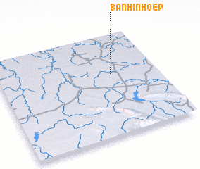 Places with similar names to Ban Hin Hoep, Thailand ::
// Ban Hin Hoep (TH)
// Ban Hin Heup (LA)
Disclaimer :: Information on this page comes without warranty of any kind |
||
|
Where is Ban Hin Hoep? Elevation and coordinates ::
Latitude (lat): 17°37'0"N Longitude (lon): 103°43'0"E
Elevation (approx.): 178m (map arrows pan, magnifying glasses zoom) |
||
|
Visiting Ban Hin Hoep? Hotel/Accommodation ::
Book a hotel in Ban Hin Hoep Travel Guide ::
Buy a travel guide for Thailand rental cars ::
car rental offers GPS waypoint ::
download a GPX waypoint (PoI) of Ban Hin Hoep for your GPS receiver
|
||