|
search place name
|
||
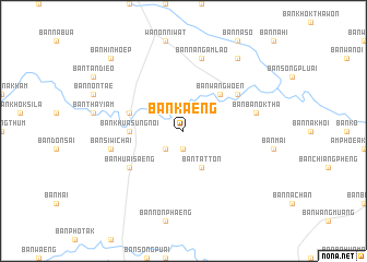
Ban Kaeng (Sakon Nakhon, Thailand)Ban Kaeng is a town in the Sakon Nakhon region of Thailand. An overview map of the region around Ban Kaeng is displayed below.
regional and 3d topo map of Ban Kaeng, Thailand ::
Ban Kaeng airports ::
The nearest airport is SNO - Sakon Nakhon, located 53.0 km south east of Ban Kaeng.
Other airports nearby include UTH - Udon Thani (107.2 km west), VTE - Vientiane Wattay Intl (138.2 km west), ZVK - Savannakhet (151.3 km south east), Nearby towns ::
Ban Nong Sanom (1.9km south) //
Ban Khua Kai (2.6km south west) //
Ban Tat Ton (4.1km south east) //
Ban Wang Woen (5.1km north east) //
Ban Khua Sung (5.3km west) //
Ban Khua Sung Noi (5.3km west) //
Ban Don Sai (5.6km west) //
Ban Huai Saeng (6.5km south west) //
Ban Kham (6.5km north east) //
Ban Si Wichai (7.3km west) //
Ban Ba Nok Tha (7.3km east) //
Ban Na Ngam Lao (7.6km north) //
Ban Khua Kai (9.1km north east) //
Ban Hin Hoep (10.2km north west) //
[all distances 'as the bird flies' and approximate]  Places with similar names to Ban Kaeng, Thailand ::
// Ban Kang (LA)
// Banakang (PH)
// Bangong (PH)
// Binguang (PH)
// Bincong (PH)
// Benking (AT)
// Ban A Kiang (TH)
// Ban Ao Kung (TH)
// Ban Kaeng (TH)
// Ban Kaeng (TH)
Disclaimer :: Information on this page comes without warranty of any kind |
||
|
Where is Ban Kaeng? Elevation and coordinates ::
Latitude (lat): 17°33'0"N Longitude (lon): 103°47'0"E
Elevation (approx.): 174m (map arrows pan, magnifying glasses zoom) |
||
|
Visiting Ban Kaeng? Hotel/Accommodation ::
Book a hotel in Ban Kaeng Travel Guide ::
Buy a travel guide for Thailand rental cars ::
car rental offers GPS waypoint ::
download a GPX waypoint (PoI) of Ban Kaeng for your GPS receiver
|
||