|
search place name
|
||
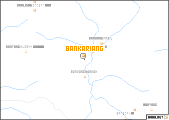
Ban Kariang (Thailand)Ban Kariang is a town in Thailand. An overview map of the region around Ban Kariang is displayed below.
regional and 3d topo map of Ban Kariang, Thailand ::
Ban Kariang airports ::
The nearest airport is MOG - Mong Hsat, located 141.7 km north east of Ban Kariang.
Other airports nearby include LPT - Lampang (146.5 km south east), THL - Tachilek Tachileik (180.2 km north east), PRH - Phrae (205.0 km south east), KET - Kengtung (237.1 km north east), Nearby towns ::
Ban Yang Nong Bua (2.5km north east) //
Ban Yang Mae Kok (3.7km south) //
Ban Wang Masiu (5.1km north east) //
[all distances 'as the bird flies' and approximate]  Places with similar names to Ban Kariang, Thailand ::
// Benquerença (PT)
// Ban Kariang (TH)
// Ban Kariang (TH)
// Ban Kariang (TH)
// Ban Kariang (TH)
// Ban Khrang (TH)
// Ban Khru Nok (TH)
// Ban Ko Rang (TH)
// Ban Ko Rong (TH)
// Ban Kraeng (TH)
Disclaimer :: Information on this page comes without warranty of any kind |
||
|
Where is Ban Kariang? Elevation and coordinates ::
Latitude (lat): 19°21'0"N Longitude (lon): 98°42'0"E
Elevation (approx.): 769m (map arrows pan, magnifying glasses zoom) |
||
|
Visiting Ban Kariang? Hotel/Accommodation ::
Book a hotel in Ban Kariang Travel Guide ::
Buy a travel guide for Thailand rental cars ::
car rental offers GPS waypoint ::
download a GPX waypoint (PoI) of Ban Kariang for your GPS receiver
|
||