|
search place name
|
||
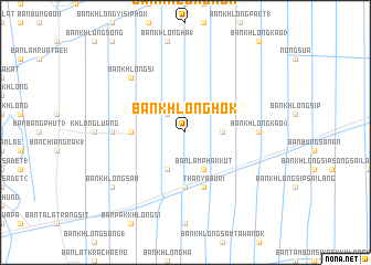
Ban Khlong Hok (Pathum Thani, Thailand)Ban Khlong Hok is a town in the Pathum Thani region of Thailand. An overview map of the region around Ban Khlong Hok is displayed below.
regional and 3d topo map of Ban Khlong Hok, Thailand ::
Ban Khlong Hok airports ::
The nearest airport is BKK - Bangkok Intl, located 21.9 km south west of Ban Khlong Hok.
Other airports nearby include UTP - Rayong U Taphao Intl (156.2 km south), NAK - Nakhon Ratchasima Khorat (173.9 km north east), HHQ - Prachuap Khiri Khan Hua Hin (179.5 km south west), Nearby towns ::
Ban Khlong Ha (2) (2.6km north west) //
Ban Khlong Chet Bon (2) (3.6km east) //
Ban Khlong Ha Bon (4.1km south west) //
Ban Lam Phak Kut (4.1km south east) //
Ban Khlong Si (5.4km west) //
Ban Rangsit (5.6km south) //
Thanya Buri (5.8km south) //
Ban Khlong Chet Sai Lang (5.8km south) //
Ban Khlong Sam (7.2km west) //
Ban Khlong Kao (6) (7.2km east) //
Ban Khlong Si (7.7km north west) //
Ban Khlong Sam (9.1km south west) //
[all distances 'as the bird flies' and approximate] 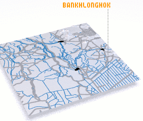 Places with similar names to Ban Khlong Hok, Thailand ::
// Ban Ka Long (TH)
// Ban Ka Long (TH)
// Ban Kalung (TH)
// Ban Kao Lang (TH)
// Ban Khlang (TH)
// Ban Khlang (TH)
// Ban Khlong (TH)
// Ban Khlong (TH)
// Ban Khlong (TH)
// Ban Khlong (TH)
Disclaimer :: Information on this page comes without warranty of any kind |
||
|
Where is Ban Khlong Hok? Elevation and coordinates ::
Latitude (lat): 14°4'0"N Longitude (lon): 100°44'0"E
Elevation (approx.): 5m (map arrows pan, magnifying glasses zoom) |
||
|
Visiting Ban Khlong Hok? Hotel/Accommodation ::
Book a hotel in Ban Khlong Hok Travel Guide ::
Buy a travel guide for Thailand rental cars ::
car rental offers GPS waypoint ::
download a GPX waypoint (PoI) of Ban Khlong Hok for your GPS receiver
|
||