|
search place name
|
||
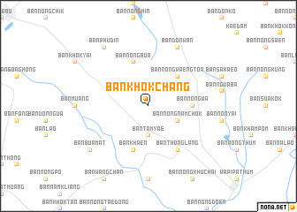
Ban Khok Chang (Maha Sarakham, Thailand)Ban Khok Chang is a town in the Maha Sarakham region of Thailand. An overview map of the region around Ban Khok Chang is displayed below.
regional and 3d topo map of Ban Khok Chang, Thailand ::
Ban Khok Chang airports ::
The nearest airport is SNO - Sakon Nakhon, located 165.7 km north east of Ban Khok Chang.
Other airports nearby include UTH - Udon Thani (169.3 km north), NAK - Nakhon Ratchasima Khorat (170.1 km south west), ZVK - Savannakhet (172.2 km north east), LOE - Loei (235.6 km north west), Nearby towns ::
Ban Tamyae (3.7km south) //
Ban Nong Nam Chok (4.0km south east) //
Ban Nong Waeng Ton (5.1km north east) //
Ban Nong Wa (5.3km east) //
Ban Khaen (5.8km south) //
Ban Nong Bua (5.8km north) //
Ban Thong Lang (6.6km south east) //
Ban Dong Yai (6.6km south east) //
Ban Don Wan (8.2km north east) //
Ban Bua Mat (9.0km south west) //
Ban Phu Din (9.1km north west) //
[all distances 'as the bird flies' and approximate]  Places with similar names to Ban Khok Chang, Thailand ::
// Ban Khok Chaeng (TH)
// Ban Khok Chaeng (TH)
// Ban Khok Chaeng (TH)
// Ban Khok Chang (TH)
// Ban Khok Chang (TH)
// Ban Khok Chang (TH)
// Ban Khok Chang (TH)
// Ban Khok Chang (TH)
// Ban Khok Chang (TH)
// Ban Khok Chang (TH)
Disclaimer :: Information on this page comes without warranty of any kind |
||
|
Where is Ban Khok Chang? Elevation and coordinates ::
Latitude (lat): 15°56'0"N Longitude (lon): 103°17'0"E
Elevation (approx.): 173m (map arrows pan, magnifying glasses zoom) |
||
|
Visiting Ban Khok Chang? Hotel/Accommodation ::
Book a hotel in Ban Khok Chang Travel Guide ::
Buy a travel guide for Thailand rental cars ::
car rental offers GPS waypoint ::
download a GPX waypoint (PoI) of Ban Khok Chang for your GPS receiver
|
||