|
search place name
|
||
Ban Na Chaluai (Ubon Ratchathani, Thailand)Ban Na Chaluai is a town in the Ubon Ratchathani region of Thailand. An overview map of the region around Ban Na Chaluai is displayed below.
regional and 3d topo map of Ban Na Chaluai, Thailand ::

Ban Na Chaluai airports ::
The nearest airport is PKZ - Pakse, located 89.4 km north east of Ban Na Chaluai.
Other airports nearby include REP - Siem-reap Siem Reap (197.0 km south west), Nearby towns ::
Ban Khok Yai (3.3km south west) //
Na Chaluai (3.5km north west) //
Ban Lak Muang (4.3km east) //
Ban Kaelae (4.5km north east) //
Ban Na Ta Yoi (6.6km south east) //
Ban Khok Noi (6.5km west) //
Ban Tum (6.9km north west) //
Ban Kham I Ok (7.1km north) //
Ban Tha Ko (7.4km north) //
Ban Kham Bon (8.0km north) //
Ban Kaeng Khilek (8.0km west) //
Ban Na Kao (8.4km south west) //
Ban Kaeng Ruang (8.6km south west) //
Ban Kham Thon (9.7km north east) //
Ban Saen Chani (10.7km north west) //
Ban Dong Khwang (11.0km north east) //
[all distances 'as the bird flies' and approximate] 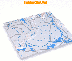 Places with similar names to Ban Na Chaluai, Thailand ::
// Bonisiolo (IT)
// Ban Cha Lo (TH)
// Ban Chaluai (TH)
// Ban Chao Lao (TH)
// Ban Cho Lae (TH)
// Ban Cho Lae (TH)
// Bānsheleh (IR)
// Boncheleh (IR)
// Boones Hill (US)
// Boonshill (US)
Disclaimer :: Information on this page comes without warranty of any kind |
||
|
Where is Ban Na Chaluai? Elevation and coordinates ::
Latitude (lat): 14°31'11"N Longitude (lon): 105°14'21"E
Elevation (approx.): 193m (map arrows pan, magnifying glasses zoom) |
||
|
Visiting Ban Na Chaluai? Hotel/Accommodation ::
Book a hotel in Ban Na Chaluai Travel Guide ::
Buy a travel guide for Thailand rental cars ::
car rental offers GPS waypoint ::
download a GPX waypoint (PoI) of Ban Na Chaluai for your GPS receiver
|
||