|
search place name
|
||
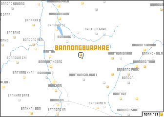
Ban Nong Bua Phae (Sakon Nakhon, Thailand)Ban Nong Bua Phae is a town in the Sakon Nakhon region of Thailand. An overview map of the region around Ban Nong Bua Phae is displayed below.
regional and 3d topo map of Ban Nong Bua Phae, Thailand ::
Ban Nong Bua Phae airports ::
The nearest airport is UTH - Udon Thani, located 76.9 km west of Ban Nong Bua Phae.
Other airports nearby include SNO - Sakon Nakhon (78.7 km south east), VTE - Vientiane Wattay Intl (108.5 km north west), ZVK - Savannakhet (175.6 km south east), LOE - Loei (188.0 km west), Nearby towns ::
Ban Thung Pla Kat (4.9km south) //
Ban Bung No (5.0km north west) //
Ban Nong Phai (5.9km north) //
Ban Thung Kae (6.4km north east) //
Ban Charoen Sin (6.7km east) //
Ban Tan (7.0km west) //
Ban Nam Thaeng (7.1km west) //
Ban Non Sang Phra (7.4km south east) //
Ban Sok (7.4km north east) //
Ban Kae Dam (7.6km south east) //
Ban Thon (8.2km south west) //
Ban Nong Wa (8.5km south east) //
Ban Khok Si (8.6km north west) //
Ban Thung Kham (8.4km east) //
Ban Khok Si (8.9km south west) //
Ban Chan (9.3km south west) //
[all distances 'as the bird flies' and approximate] 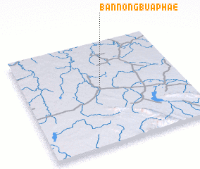 Places with similar names to Ban Nong Bua Phae, Thailand :: Disclaimer :: Information on this page comes without warranty of any kind |
||
|
Where is Ban Nong Bua Phae? Elevation and coordinates ::
Latitude (lat): 17°33'58"N Longitude (lon): 103°29'14"E
Elevation (approx.): 171m (map arrows pan, magnifying glasses zoom) |
||
|
Visiting Ban Nong Bua Phae? Hotel/Accommodation ::
Book a hotel in Ban Nong Bua Phae Travel Guide ::
Buy a travel guide for Thailand rental cars ::
car rental offers GPS waypoint ::
download a GPX waypoint (PoI) of Ban Nong Bua Phae for your GPS receiver
|
||