|
search place name
|
||
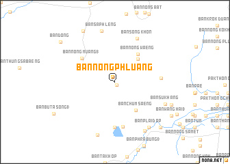
Ban Nong Phluang (Nakhon Ratchasima, Thailand)Ban Nong Phluang is a town in the Nakhon Ratchasima region of Thailand. An overview map of the region around Ban Nong Phluang is displayed below.
regional and 3d topo map of Ban Nong Phluang, Thailand ::
Ban Nong Phluang airports ::
The nearest airport is NAK - Nakhon Ratchasima Khorat, located 30.6 km north east of Ban Nong Phluang.
Other airports nearby include BKK - Bangkok Intl (164.5 km south west), REP - Siem-reap Siem Reap (257.2 km south east), Nearby towns ::
Ban Nong Maeng Ngot (0.6km south east) //
Ban Nong Waen (5.2km north east) //
Ban Chumsaeng (5.7km south east) //
Ban Nong Waeng (5.7km north east) //
Ban Nong Muang (1) (6.4km north west) //
Ban Phu Pla Lai (7.4km south) //
Ban Mai Yang Kathung (7.4km south) //
Ban Bo Phran (7.3km east) //
Ban Song Khon (7.9km north east) //
Ban Sa Phleng (8.6km north) //
Ban Su Khang (8.7km south east) //
Ban Yang Kathung (9.1km south) //
Ban Plai Dap (9.2km south east) //
Ban Bu Cha-om (1) (9.3km south east) //
Ban Non Na (9.7km north west) //
Ban Nong Pla Lai (1) (10.3km south east) //
Ban Nong Chum Saeng (1) (10.3km south east) //
[all distances 'as the bird flies' and approximate] 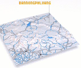 Places with similar names to Ban Nong Phluang, Thailand ::
// Ban Nong Phai Lang (TH)
// Ban Nong Phlong (TH)
// Ban Nong Phlong (TH)
// Ban Nong Phluang (TH)
// Ban Nong Phluang (TH)
// Ban Nong Phluang (TH)
// Ban Nong Phluang (TH)
// Ban Nong Phluang (TH)
// Ban Nong Phluang (TH)
// Ban Nong Phluang (TH)
Disclaimer :: Information on this page comes without warranty of any kind |
||
|
Where is Ban Nong Phluang? Elevation and coordinates ::
Latitude (lat): 14°45'0"N Longitude (lon): 101°52'0"E
Elevation (approx.): 247m (map arrows pan, magnifying glasses zoom) |
||
|
Visiting Ban Nong Phluang? Hotel/Accommodation ::
Book a hotel in Ban Nong Phluang Travel Guide ::
Buy a travel guide for Thailand rental cars ::
car rental offers GPS waypoint ::
download a GPX waypoint (PoI) of Ban Nong Phluang for your GPS receiver
|
||