|
search place name
|
||
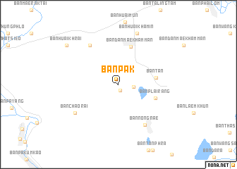
Ban Pak (Sukhothai, Thailand)Ban Pak is a town in the Sukhothai region of Thailand. An overview map of the region around Ban Pak is displayed below.
regional and 3d topo map of Ban Pak, Thailand ::
Ban Pak airports ::
The nearest airport is PRH - Phrae, located 76.3 km north of Ban Pak.
Other airports nearby include PHS - Phitsanulok (84.9 km south east), LPT - Lampang (99.3 km north west), LOE - Loei (189.3 km east), Nearby towns ::
Ban Rai (0.9km south) //
Ban Bung Suai (2.3km east) //
Ban Tan (5.8km east) //
Ban Plai Rang (6.0km east) //
Ban Dan Mae Kham Man (6.3km north) //
Ban Nong Nae (7.6km south east) //
Ban Dong Khu (7.6km north west) //
Ban Chao Rai (8.0km south west) //
Ban Huai Khamin (8.5km north) //
Ban Huai Khrai (10.0km north west) //
[all distances 'as the bird flies' and approximate] 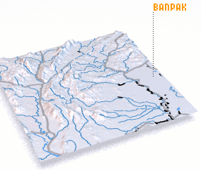 Places with similar names to Ban Pak, Thailand ::
// Ban Pak (TH)
// Ban Pak (TH)
// Ban Pa Kae (TH)
// Ban Pa Kao (TH)
// Ban Pa Kao (TH)
// Ban Pa Kia (TH)
// Ban Pak Ka (TH)
// Ban Pak Kiu (TH)
// Ban Pak Ko (TH)
// Ban Pa Ko (TH)
Disclaimer :: Information on this page comes without warranty of any kind |
||
|
Where is Ban Pak? Elevation and coordinates ::
Latitude (lat): 17°28'39"N Longitude (lon): 99°56'26"E
Elevation (approx.): 59m (map arrows pan, magnifying glasses zoom) |
||
|
Visiting Ban Pak? Hotel/Accommodation ::
Book a hotel in Ban Pak Travel Guide ::
Buy a travel guide for Thailand rental cars ::
car rental offers GPS waypoint ::
download a GPX waypoint (PoI) of Ban Pak for your GPS receiver
|
||