|
search place name
|
||
Ban Phakae (Mae Hong Son, Thailand)Ban Phakae is a town in the Mae Hong Son region of Thailand. An overview map of the region around Ban Phakae is displayed below.
regional and 3d topo map of Ban Phakae, Thailand ::

Ban Phakae airports ::
The nearest airport is LPT - Lampang, located 185.2 km east of Ban Phakae.
Other airports nearby include MOG - Mong Hsat (253.2 km north east), RGN - Yangon Intl (265.2 km south west), Nearby towns ::
Ban Phatho (1.9km south) //
Ban Huai San (3.0km east) //
Ban Huai Khi (4.2km north east) //
Ban Pa Piang Luang (4.6km east) //
Lota (4.7km west) //
Ban Mae Ki (6.6km south east) //
Wisalaw (7.0km west) //
Ban Huai Khlong Se (7.1km east) //
Ban Huai Ton Nun (7.6km north) //
Ban Mae Kho (8.3km south east) //
Ban Huai Khan (8.2km east) //
[all distances 'as the bird flies' and approximate] 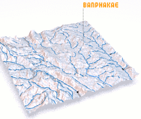 Places with similar names to Ban Phakae, Thailand ::
// Benfica (PT)
// Ban Faek (TH)
// Ban Fai Kaeo (TH)
// Ban Fai Kaeo (TH)
// Ban Na Faek (TH)
// Ban Na Faek (TH)
// Ban Na Faek (TH)
// Ban Na Phuak (TH)
// Ban Nop Hak (TH)
// Ban Phae (2) (TH)
Disclaimer :: Information on this page comes without warranty of any kind |
||
|
Where is Ban Phakae? Elevation and coordinates ::
Latitude (lat): 18°41'21"N Longitude (lon): 97°48'21"E
Elevation (approx.): 594m (map arrows pan, magnifying glasses zoom) |
||
|
Visiting Ban Phakae? Hotel/Accommodation ::
Book a hotel in Ban Phakae Travel Guide ::
Buy a travel guide for Thailand rental cars ::
car rental offers GPS waypoint ::
download a GPX waypoint (PoI) of Ban Phakae for your GPS receiver
|
||