|
search place name
|
||
Ban Tako (Nakhon Ratchasima, Thailand)Ban Tako is a town in the Nakhon Ratchasima region of Thailand. An overview map of the region around Ban Tako is displayed below.
regional and 3d topo map of Ban Tako, Thailand ::

Ban Tako airports ::
The nearest airport is NAK - Nakhon Ratchasima Khorat, located 52.4 km south of Ban Tako.
Other airports nearby include UTH - Udon Thani (229.6 km north), BKK - Bangkok Intl (235.2 km south west), PHS - Phitsanulok (253.4 km north west), REP - Siem-reap Siem Reap (282.8 km south east), Nearby towns ::
Ban Khu Muang (1.9km north) //
Ban Non Ya Kha (1.9km south) //
Ban Non Chaeng (2.6km south east) //
Ban Ngiu (6.5km north west) //
Ban Khu Wuk (6.6km south west) //
Ban Muang Nat (7.1km east) //
Ban Taluk Hin (7.1km west) //
Ban Kham (7.4km south) //
Ban Hin Tang (7.4km east) //
Ban Mai Nong Fan (7.4km east) //
Ban Nua (7.4km east) //
Kham Sakae Saeng (7.6km south) //
Ban Sa Chaeng Nua (7.4km west) //
Ban Prakham (8.2km north west) //
Ban Taluk Sarai (9.1km north east) //
[all distances 'as the bird flies' and approximate] 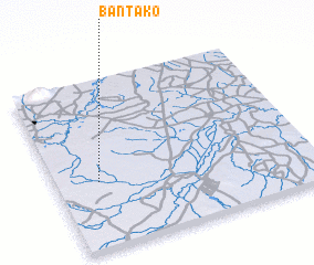 Places with similar names to Ban Tako, Thailand ::
Disclaimer :: Information on this page comes without warranty of any kind |
||
|
Where is Ban Tako? Elevation and coordinates ::
Latitude (lat): 15°24'0"N Longitude (lon): 102°10'0"E
Elevation (approx.): 191m (map arrows pan, magnifying glasses zoom) |
||
|
Visiting Ban Tako? Hotel/Accommodation ::
Book a hotel in Ban Tako Travel Guide ::
Buy a travel guide for Thailand rental cars ::
car rental offers GPS waypoint ::
download a GPX waypoint (PoI) of Ban Tako for your GPS receiver
|
||