|
search place name
|
||
Ban Talat (Ubon Ratchathani, Thailand)Ban Talat is a town in the Ubon Ratchathani region of Thailand. An overview map of the region around Ban Talat is displayed below.
regional and 3d topo map of Ban Talat, Thailand ::

Ban Talat airports ::
The nearest airport is PKZ - Pakse, located 81.0 km east of Ban Talat.
Other airports nearby include ZVK - Savannakhet (186.2 km north), REP - Siem-reap Siem Reap (213.2 km south west), Nearby towns ::
Det Udom (1.3km north east) //
Ban Khaem Charoen (1.7km south west) //
Ban Wari Udom (5.3km south) //
Ban Nong Yao (6.0km east) //
Ban Nong Samran (6.5km north west) //
Ban Som Sa-at (6.5km north east) //
Ban Tha Pho (6.6km south) //
Ban Klang (8.5km south east) //
Bah Nong Krabu (8.8km north) //
Ban Kham Na Saeng (9.1km north east) //
Ban Pa Mong (10.1km north west) //
[all distances 'as the bird flies' and approximate] 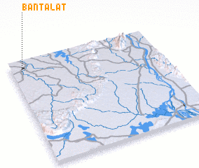 Places with similar names to Ban Talat, Thailand ::
Disclaimer :: Information on this page comes without warranty of any kind |
||
|
Where is Ban Talat? Elevation and coordinates ::
Latitude (lat): 14°54'0"N Longitude (lon): 105°4'0"E
Elevation (approx.): 137m (map arrows pan, magnifying glasses zoom) |
||
|
Visiting Ban Talat? Hotel/Accommodation ::
Book a hotel in Ban Talat Travel Guide ::
Buy a travel guide for Thailand rental cars ::
car rental offers GPS waypoint ::
download a GPX waypoint (PoI) of Ban Talat for your GPS receiver
|
||