|
search place name
|
||
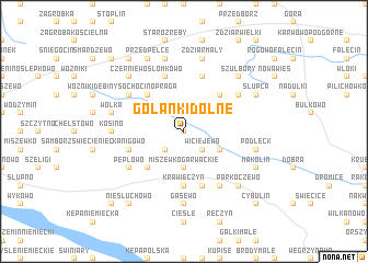
Golanki Dolne (Poland)Golanki Dolne is a town in Poland. An overview map of the region around Golanki Dolne is displayed below.
regional and 3d topo map of Golanki Dolne, Poland ::
Golanki Dolne airports ::
The nearest airport is WAW - Warsaw Okecie, located 78.5 km south east of Golanki Dolne.
Other airports nearby include GDN - Gdansk Lecha Walesy (227.5 km north west), Nearby towns ::
Golanki (0.0km north) //
Blichowo (1.9km north) //
Golanki Górne (2.2km south west) //
Wiciejewo (2.2km south east) //
Miszewko Garwackie (3.7km south) //
Leksyn (2.9km south east) //
Wołowa (2.9km north west) //
Małoszewo (4.3km south west) //
Parcele łubki (4.3km north east) //
Sochocino-Praga (4.3km north west) //
Krawięczyn (5.6km south) //
Bodzanów (5.7km south) //
Kanigowo (3.9km south west) //
Ostrzykowo (5.7km north) //
Przedpełce Włosty (5.7km north) //
Słomkowo (5.7km north) //
Chodkowo (6.0km south) //
Pepłowo (5.0km south west) //
Łubki (5.0km north east) //
Łoniewo (5.0km north west) //
Gąsewo (7.4km south) //
Kosino (4.5km west) //
Podleck (4.9km east) //
Łętowo (4.9km east) //
Wólka (4.9km west) //
Zdziar Mały (7.5km north) //
Białęgi (7.5km north) //
Parkoczewo (6.5km south east) //
Szulbory (6.5km north east) //
[all distances 'as the bird flies' and approximate]  Places with similar names to Golanki Dolne, Poland ::
// Glinik Dolny (PL)
// Kolonia Kietlin (PL)
Disclaimer :: Information on this page comes without warranty of any kind |
||
|
Where is Golanki Dolne? Elevation and coordinates ::
Latitude (lat): 52°33'0"N Longitude (lon): 20°0'0"E
Elevation (approx.): 117m (map arrows pan, magnifying glasses zoom) |
||
|
Visiting Golanki Dolne? Hotel/Accommodation ::
Book a hotel in Golanki Dolne Travel Guide ::
Buy a travel guide for Poland rental cars ::
car rental offers GPS waypoint ::
download a GPX waypoint (PoI) of Golanki Dolne for your GPS receiver
|
||