|
search place name
|
||
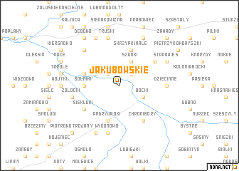
Jakubowskie (Poland)Jakubowskie is a town in Poland. An overview map of the region around Jakubowskie is displayed below.
regional and 3d topo map of Jakubowskie, Poland ::
Nearby towns ::
Wiercień (2.2km north east) //
Olszewo (2.2km north east) //
Bodaki (2.2km north west) //
Szumki (3.9km north) //
Boćki (2.9km south east) //
Bodaczki (2.9km north west) //
Solniki (3.4km west) //
Skrzypki Małe (5.7km north) //
Skalimowo (3.8km north west) //
Andryjanki (5.7km south) //
Chronibory (6.0km south) //
Hawryłki (5.0km north east) //
Siekluki (5.0km south west) //
Dziecinne (4.5km east) //
Truski (7.5km north) //
Wygonowo (7.5km south) //
Zołocki (4.9km west) //
Chojewo (6.5km north west) //
Skrzypki Duże (7.7km north) //
Starowieś (5.8km north east) //
Koszewo (7.7km north) //
Piotrowo Krzywokoły (7.7km south) //
Dębowo (8.1km north west) //
Zawady (8.7km north east) //
Bolesty (8.7km north east) //
Piotrowo Trojany (8.7km south west) //
[all distances 'as the bird flies' and approximate]  Places with similar names to Jakubowskie, Poland ::
Disclaimer :: Information on this page comes without warranty of any kind |
||
|
Where is Jakubowskie? Elevation and coordinates ::
Latitude (lat): 52°40'0"N Longitude (lon): 23°1'0"E
Elevation (approx.): 143m (map arrows pan, magnifying glasses zoom) |
||
|
Visiting Jakubowskie? Hotel/Accommodation ::
Book a hotel in Jakubowskie Travel Guide ::
Buy a travel guide for Poland rental cars ::
car rental offers GPS waypoint ::
download a GPX waypoint (PoI) of Jakubowskie for your GPS receiver
|
||