|
search place name
|
||
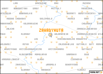
Zawady Huta (Poland)Zawady Huta is a town in Poland. An overview map of the region around Zawady Huta is displayed below.
regional and 3d topo map of Zawady Huta, Poland ::
Zawady Huta airports ::
The nearest airport is WAW - Warsaw Okecie, located 91.8 km south of Zawady Huta.
Other airports nearby include KGD - Kaliningrad Khrabrovo (215.4 km north), Nearby towns ::
Goloniwy (1.9km south) //
Podoś Stary (1.1km west) //
Zawady (1.1km east) //
Zawady Dworskie (2.2km south east) //
Wola Pienicka Szlachta (2.2km east) //
Wola Pienicka (2.2km east) //
Krzyżewo Borowe (3.9km south) //
Wola Pienicka Włościanie (2.9km north east) //
Łęg (3.8km south west) //
Rzechowo Wielkie (3.8km south east) //
Krzyżewo Marki (5.7km south) //
Sielc Piekło (5.7km north) //
Krasnosielc (5.7km north) //
Sielc Kolonia (5.7km north) //
Zalesie Wielkie (5.0km south east) //
Łazy (6.0km north) //
Gąsewo (4.5km east) //
Jaciążek (4.8km south west) //
Szczeglin (4.8km north east) //
Szczeglin Poduchowny (4.8km north east) //
Popielarka (7.7km south) //
Kolonia Suche (5.8km north west) //
Krzyżewo Nadrzeczne (7.1km south west) //
Kobylin (7.1km south west) //
Bagienice Szlacheckie (8.1km north east) //
Pienice (7.1km north east) //
Obłudzin (8.7km south west) //
Dąbrówka (8.7km south east) //
Biernaty (8.7km north east) //
[all distances 'as the bird flies' and approximate]  Places with similar names to Zawady Huta, Poland :: Disclaimer :: Information on this page comes without warranty of any kind |
||
|
Where is Zawady Huta? Elevation and coordinates ::
Latitude (lat): 52°59'0"N Longitude (lon): 21°9'0"E
Elevation (approx.): 106m (map arrows pan, magnifying glasses zoom) |
||
|
Visiting Zawady Huta? Hotel/Accommodation ::
Book a hotel in Zawady Huta Travel Guide ::
Buy a travel guide for Poland rental cars ::
car rental offers GPS waypoint ::
download a GPX waypoint (PoI) of Zawady Huta for your GPS receiver
|
||