|
search place name
|
||
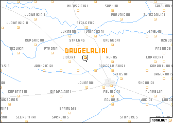
Daugėlaliai (Lithuania)Daugėlaliai is a town in Lithuania. An overview map of the region around Daugėlaliai is displayed below.
regional and 3d topo map of Daugėlaliai, Lithuania ::
Daugėlaliai airports ::
The nearest airport is KGD - Kaliningrad Khrabrovo, located 127.4 km south west of Daugėlaliai.
Nearby towns ::
Bubėnai (2.1km north east) //
Skroblis (2.1km south west) //
Druobstai (2.1km south east) //
Lioliai (2.1km west) //
Stalgas (3.9km north) //
Alkas (3.1km east) //
Jaupėnai (5.6km south) //
Vainaičiai (5.7km north) //
Norgalviškiai (3.6km south east) //
Užupiai (3.6km south west) //
Luknėnai (5.9km north) //
Daugėdai (4.8km north east) //
Maldučiai (5.9km south) //
Stalgėnai (7.4km north) //
Rietavas (6.0km south east) //
Pyvorai (4.6km north west) //
Vatušiai (5.6km south east) //
Girdvainiai (8.0km south west) //
Pelaičiai (8.0km south east) //
[all distances 'as the bird flies' and approximate] 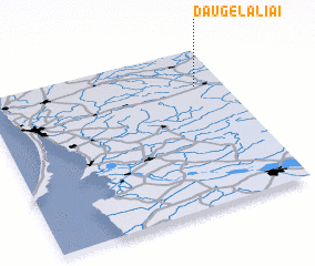 Places with similar names to Daugėlaliai, Lithuania ::
Disclaimer :: Information on this page comes without warranty of any kind |
||
|
Where is Daugėlaliai? Elevation and coordinates ::
Latitude (lat): 55°46'0"N Longitude (lon): 21°53'0"E
Elevation (approx.): 122m (map arrows pan, magnifying glasses zoom) |
||
|
Visiting Daugėlaliai? Hotel/Accommodation ::
Book a hotel in Daugėlaliai Travel Guide ::
Buy a travel guide for Lithuania rental cars ::
car rental offers GPS waypoint ::
download a GPX waypoint (PoI) of Daugėlaliai for your GPS receiver
|
||