|
search place name
|
||
Pagulianka (Lithuania)Pagulianka is a town in Lithuania. An overview map of the region around Pagulianka is displayed below.
regional and 3d topo map of Pagulianka, Lithuania ::

Nearby towns ::
Jurgaičiai (0.8km south east) //
Linkuva (1.9km south) //
Ruponiai (2.2km north) //
Tričiai (2.5km east) //
Mikalajūnai (2.9km north west) //
Voronėliai (3.5km west) //
Šikšniai (3.6km east) //
Gataučiai (6.5km north) //
Gaižiūnai (4.9km north west) //
Girbutkiai (6.9km south) //
Megučioniai (5.8km south west) //
Dūčiai (4.5km south west) //
Ūdekai (6.3km north east) //
Titoniai (6.4km south east) //
Tulminiai (6.1km north west) //
Pamūšis (8.1km south) //
Puodžiūnai (7.7km north) //
Pamuckai (8.2km south) //
Rimkūnai (6.4km north west) //
Plikeliai (4.9km west) //
Dvariūkai (5.5km south east) //
Petrašiūnai (8.7km south) //
[all distances 'as the bird flies' and approximate] 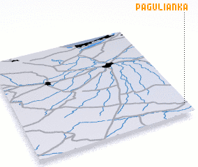 Places with similar names to Pagulianka, Lithuania ::
// Pakklōhng (MM)
// Pikouliánika (GR)
// Poço Longo (PT)
// Piekielnik (PL)
// Paclanca (PE)
// Pak Luong (LA)
// Paklenik (BA)
// Pác Liêng (VN)
// Pac Loung (VN)
// Pac Luong (VN)
Disclaimer :: Information on this page comes without warranty of any kind |
||
|
Where is Pagulianka? Elevation and coordinates ::
Latitude (lat): 56°6'9"N Longitude (lon): 23°58'40"E
Elevation (approx.): 57m (map arrows pan, magnifying glasses zoom) |
||
|
Visiting Pagulianka? Hotel/Accommodation ::
Book a hotel in Pagulianka Travel Guide ::
Buy a travel guide for Lithuania rental cars ::
car rental offers GPS waypoint ::
download a GPX waypoint (PoI) of Pagulianka for your GPS receiver
|
||