|
search place name
|
||
Al Jabalāw (Qinā, Egypt)Al Jabalāw is a town in the Qinā region of Egypt. An overview map of the region around Al Jabalāw is displayed below.
regional and 3d topo map of Al Jabalāw, Egypt ::

Al Jabalāw airports ::
The nearest airport is LXR - Luxor Intl, located 51.8 km south of Al Jabalāw.
Other airports nearby include HRG - Hurghada Intl (154.1 km north east), Nearby towns ::
Naj‘ ‘Urābī (1.2km south) //
Naj‘ al ‘Abbūdī (1.5km south east) //
Naj‘ al Shuwaynah (1.8km north west) //
Naj‘ ‘Arab as Sabḩah (2.0km south) //
Aş Şāliḩīyah (2.1km north west) //
Al Khirbah (2.2km south west) //
Naj‘ al Kawm (2.4km south west) //
Naj‘ ad Dawmah (3.2km south east) //
Al Ashrāf (3.9km south) //
Al Ashrāf (4.3km south) //
Naj‘ al Ḩayy (4.3km south east) //
Naj‘ Ḩamad Allāh (5.1km south east) //
Aţ Ţuwayrāt (5.1km south west) //
Al Ashrāf al ‘Asalīyah (5.6km south) //
Karm ‘Umrān (6.3km south east) //
Qinā (6.4km north west) //
Al Ḩamīdāt (6.3km west) //
Naj‘ al Bashshārīyah (6.8km south east) //
Ad Dayr ash Sharqī (7.6km south) //
Naj‘ al Jidd (7.8km south east) //
At Tarāmisah (7.2km west) //
Naj‘ Jibrīl (9.0km south east) //
Naj‘ Abū Raḑwān (9.7km south east) //
[all distances 'as the bird flies' and approximate] 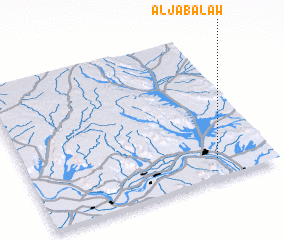 Places with similar names to Al Jabalāw, Egypt ::
Disclaimer :: Information on this page comes without warranty of any kind |
||
|
Where is Al Jabalāw? Elevation and coordinates ::
Latitude (lat): 26°8'2"N Longitude (lon): 32°46'37"E
Elevation (approx.): 82m (map arrows pan, magnifying glasses zoom) |
||
|
Visiting Al Jabalāw? Hotel/Accommodation ::
Book a hotel in Al Jabalāw Travel Guide ::
Buy a travel guide for Egypt rental cars ::
car rental offers GPS waypoint ::
download a GPX waypoint (PoI) of Al Jabalāw for your GPS receiver
|
||