|
search place name
|
||
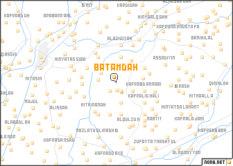
Batamdah (Al Qalyūbīyah, Egypt)Batamdah is a town in the Al Qalyūbīyah region of Egypt. An overview map of the region around Batamdah is displayed below.
regional and 3d topo map of Batamdah, Egypt ::
Batamdah airports ::
The nearest airport is CAI - Cairo Intl, located 35.7 km south of Batamdah.
Other airports nearby include PSD - Port Said (130.8 km north east), ALY - Alexandria Intl (153.5 km north west), Nearby towns ::
Jazīrat Billī (1.2km south) //
Nazlat ‘Awdah Ḩammūd (1.5km south east) //
Nazlat as Sibā‘āt (1.5km south east) //
Al Majāzir (1.6km south east) //
Nazlat Salmān Zāʼid (1.6km south west) //
Minshāt Dhiʼāb (1.6km south west) //
Kafr ash Sha‘āwirah (2.5km north) //
Aş Şanāfīn al Qiblīyah (2.8km north) //
Kafr az Zaqāzīq al Qiblī (2.6km south east) //
Kafr ash Shaykh Ibrāhīm (2.6km west) //
Kafr ‘Aţāʼ Allāh (2.7km north west) //
Naj‘ Ghānim Abū Raʼs (3.3km south) //
‘Arab al Muqābilah (3.3km south) //
Nazlat Buşaylān (3.3km south) //
Banī Ḩusayn (3.3km north east) //
Aş Şanāfīn al Baḩrīyah (4.3km north) //
Sanhūt al Birak (4.2km north east) //
Kafr Salāmah Ibrāhīm (3.8km east) //
Kafr ‘Abd an Nabī (4.1km east) //
Kafr Ayyūb ‘Awaḑ (4.5km north east) //
Kafr Yūsuf Simrī (4.5km north east) //
Kafr ash Shaykhah Sālimah (5.1km south) //
Nazlat ar Rawāshidah (5.1km south) //
Quţayyifat al ‘Azīzīyah (4.9km north west) //
Kafr Abū Zahrah (4.8km north west) //
Kafr ‘Alī Ghālī (5.0km south east) //
‘Izbat Muḩammad Bāshāt (4.7km west) //
Shubrā al ‘Inab (4.8km east) //
Marsafa (5.0km south west) //
[all distances 'as the bird flies' and approximate] 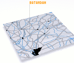 Places with similar names to Batamdah, Egypt ::
// Bou Tammaït (MA)
// Bayt Aḩmad (IQ)
// Budim Do (BA)
// Batti Motti (IN)
// Batumoito (ID)
// Batamote (MX)
// Batamote (MX)
// Badoumba Diaé (SN)
// Bet Ahmad (PK)
// Bodomtu (TJ)
Disclaimer :: Information on this page comes without warranty of any kind |
||
|
Where is Batamdah? Elevation and coordinates ::
Latitude (lat): 30°25'43"N Longitude (lon): 31°17'35"E
Elevation (approx.): 16m (map arrows pan, magnifying glasses zoom) |
||
|
Visiting Batamdah? Hotel/Accommodation ::
Book a hotel in Batamdah Travel Guide ::
Buy a travel guide for Egypt rental cars ::
car rental offers GPS waypoint ::
download a GPX waypoint (PoI) of Batamdah for your GPS receiver
|
||