|
search place name
|
||
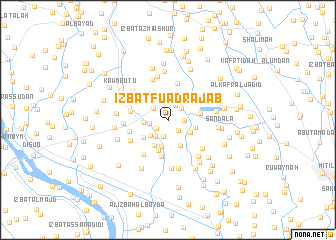
‘Izbat Fuʼād Rajab (Kafr ash Shaykh, Egypt)‘Izbat Fuʼād Rajab is a town in the Kafr ash Shaykh region of Egypt. An overview map of the region around ‘Izbat Fuʼād Rajab is displayed below.
regional and 3d topo map of ‘Izbat Fuʼād Rajab, Egypt ::
‘Izbat Fuʼād Rajab airports ::
The nearest airport is ALY - Alexandria Intl, located 79.4 km west of ‘Izbat Fuʼād Rajab.
Other airports nearby include CAI - Cairo Intl (130.2 km south east), PSD - Port Said (139.6 km east), Nearby towns ::
‘Izbat Abū Muraykib (1.4km south west) //
‘Izbat Ḩumaydah ‘Abbūd (1.6km south east) //
Ash Shabāsīyah (1.5km east) //
Kafr ‘Alī Abū Ziyādah (1.7km north east) //
‘Izbat ad Duktūr Muḩammad Khalīl (1.9km south) //
‘Izbat Nuwaysh (1.8km north east) //
Ash Shuwan (1.8km west) //
‘Izbat ad Duktūr Muḩammad ‘Abd al Khāliq (1.9km north west) //
‘Izbat Yaḩyá (2.1km south west) //
Shābah (2.3km north) //
‘Izbat ‘Abd ar Raḩmān (2.4km south west) //
Al ‘Ajūzayn (2.3km west) //
‘Izbat Abū al Kanāyis (2.6km south east) //
‘Izbat Yūsuf ash Sharnūbī (3.0km south) //
‘Izbat ash Shūkah (2.9km north west) //
Ḩişşat al Ghunaymī (3.1km south east) //
‘Izbat Ḩasan ash Shawādifī (2.8km east) //
‘Izbat al Janbīyah (3.1km south west) //
‘Izbat al Mistikāwī (3.1km south west) //
‘Izbat Badr ad Dīn (3.5km south) //
‘Izbat Labīb ‘Aţīyah (3.2km east) //
Al Ghunaymī (4.1km south) //
‘Izbat al Işlāḩ (4.2km north) //
‘Izbat Khalīl al Qaşşāş (3.7km west) //
‘Izbat ‘Abd al Jalīl (3.9km west) //
Minshāt Baţţāḩ (4.5km south west) //
‘Izbat al Ḩayţah (4.2km south west) //
‘Izbat ath Thamānīn (4.8km north) //
‘Izbat Muḩammad ad Daqdūqī (4.3km west) //
[all distances 'as the bird flies' and approximate]  Places with similar names to ‘Izbat Fuʼād Rajab, Egypt :: Disclaimer :: Information on this page comes without warranty of any kind |
||
|
Where is ‘Izbat Fuʼād Rajab? Elevation and coordinates ::
Latitude (lat): 31°9'54"N Longitude (lon): 30°46'52"E
Elevation (approx.): 3m (map arrows pan, magnifying glasses zoom) |
||
|
Visiting ‘Izbat Fuʼād Rajab? Hotel/Accommodation ::
Book a hotel in ‘Izbat Fuʼād Rajab Travel Guide ::
Buy a travel guide for Egypt rental cars ::
car rental offers GPS waypoint ::
download a GPX waypoint (PoI) of ‘Izbat Fuʼād Rajab for your GPS receiver
|
||