|
search place name
|
||
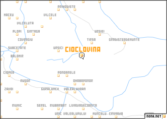
Cioclovina (Covurlui, Romania)Cioclovina is a town in the Covurlui region of Romania. An overview map of the region around Cioclovina is displayed below.
regional and 3d topo map of Cioclovina, Romania ::
Cioclovina airports ::
The nearest airport is CSB - Caransebes, located 71.1 km west of Cioclovina.
Other airports nearby include SBZ - Sibiu (77.9 km east), TGM - Tirgu Mures Vidrasau (139.5 km north east), CLJ - Cluj-napoca Cluj Napoca (140.2 km north), TSR - Timisoara Traian Vuia (142.1 km west), Nearby towns ::
Tîrşa (3.9km north) //
Ponoarele (4.5km south west) //
Ohaba-Ponor (5.6km south) //
Federi (5.7km south) //
Ursici (4.3km north west) //
Fizeşti (5.4km south west) //
Luncani (6.1km north east) //
Ursiei (6.1km north east) //
Valea lui Ioan (7.5km south) //
Ponor (7.5km south) //
Pui (7.9km south) //
Gura Luncii (9.1km south west) //
Galaţi (9.1km south west) //
[all distances 'as the bird flies' and approximate] 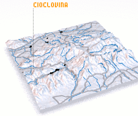 Places with similar names to Cioclovina, Romania ::
// Schlieven (DE)
// Scholven (DE)
// Sklávaina (GR)
// Sklavoúna (GR)
// Sklívani (GR)
// Skilvioniai (LT)
// Skilvioniai (LT)
// Sokolovina (BA)
// Ceclavín (ES)
// Sclafani (IT)
Disclaimer :: Information on this page comes without warranty of any kind |
||
|
Where is Cioclovina? Elevation and coordinates ::
Latitude (lat): 45°35'0"N Longitude (lon): 23°8'0"E
Elevation (approx.): 611m (map arrows pan, magnifying glasses zoom) |
||
|
Visiting Cioclovina? Hotel/Accommodation ::
Book a hotel in Cioclovina Travel Guide ::
Buy a travel guide for Romania rental cars ::
car rental offers GPS waypoint ::
download a GPX waypoint (PoI) of Cioclovina for your GPS receiver
|
||