|
search place name
|
||
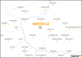
Sarıyayla (Ordu, Turkey)Sarıyayla is a town in the Ordu region of Turkey. An overview map of the region around Sarıyayla is displayed below.
regional and 3d topo map of Sarıyayla, Turkey ::
Sarıyayla airports ::
The nearest airport is VAS - Sivas, located 109.9 km south west of Sarıyayla.
Other airports nearby include ERC - Erzincan (176.6 km south east), EZS - Elazig (252.4 km south east), Nearby towns ::
Dursunlu (3.7km north) //
Yeşilce (3.5km east) //
Konacık (4.7km south east) //
Beyseki (4.7km south west) //
Yağmurlar (5.6km south east) //
Topçam (8.1km north) //
Beyağac (6.7km north east) //
Bakırköy (6.7km north west) //
Kavaklıdere (7.9km south east) //
Güzelce (9.3km north west) //
[all distances 'as the bird flies' and approximate] 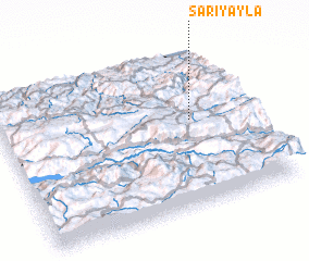 Places with similar names to Sarıyayla, Turkey ::
// Sarıyayla (TR)
// Sarıyayla (TR)
// Sürüyolu (TR)
// Souryala (BF)
// Saryaul (KZ)
// Seryāl (IR)
// Sorhyŏl-li (KP)
// Suryeul (KR)
// Sarā-ye ‘Ālī (IR)
// Sarayul' (RU)
Disclaimer :: Information on this page comes without warranty of any kind |
||
|
Where is Sarıyayla? Elevation and coordinates ::
Latitude (lat): 40°33'0"N Longitude (lon): 37°46'0"E
Elevation (approx.): 1500m (map arrows pan, magnifying glasses zoom) |
||
|
Visiting Sarıyayla? Hotel/Accommodation ::
Book a hotel in Sarıyayla Travel Guide ::
Buy a travel guide for Turkey rental cars ::
car rental offers GPS waypoint ::
download a GPX waypoint (PoI) of Sarıyayla for your GPS receiver
|
||