|
search place name
|
||
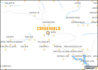
Candemuela (Castilla y León, Spain)Candemuela is a town in the Castilla y León region of Spain. An overview map of the region around Candemuela is displayed below.
regional and 3d topo map of Candemuela, Spain ::
Candemuela airports ::
The nearest airport is OVD - Aviles Asturias, located 64.5 km north of Candemuela.
Other airports nearby include BGC - Braganca (137.9 km south west), VLL - Valladolid (170.5 km south east), VRL - Vila Real (237.2 km south west), Nearby towns ::
San Emiliano (1.9km south) //
La Majua (1.4km west) //
Pinos (1.4km east) //
Villargusán (2.3km north east) //
Torrebarrio (3.7km north) //
Villafeliz (3.9km south) //
Villasecino (3.9km south) //
Genestosa (3.9km north) //
Cospedal (4.5km south west) //
Truébano (5.7km south) //
Rabanal (6.2km south east) //
Robledo (5.7km west) //
Torrestío (8.5km north west) //
Santa Eulalia de las Manzanas (9.2km south east) //
[all distances 'as the bird flies' and approximate]  Places with similar names to Candemuela, Spain ::
// Kandamal (PH)
// Kent Mill (US)
// Candemil (PT)
// Candemil (PT)
// Contumil (PT)
// Gontomil (PT)
// Candamil (ES)
// Quindimil (ES)
// Kennedy Mill (US)
// Kennedy Mill (US)
Disclaimer :: Information on this page comes without warranty of any kind |
||
|
Where is Candemuela? Elevation and coordinates ::
Latitude (lat): 42°59'0"N Longitude (lon): 6°0'0"W
Elevation (approx.): 1193m (map arrows pan, magnifying glasses zoom) |
||
|
Visiting Candemuela? Hotel/Accommodation ::
Book a hotel in Candemuela Travel Guide ::
Buy a travel guide for Spain rental cars ::
car rental offers GPS waypoint ::
download a GPX waypoint (PoI) of Candemuela for your GPS receiver
|
||