|
search place name
|
||
Làng Vang (Vietnam)Làng Vang is a town in Vietnam. An overview map of the region around Làng Vang is displayed below.
regional and 3d topo map of Làng Vang, Vietnam ::

Làng Vang airports ::
The nearest airport is HAN - Hanoi Noibai Intl, located 103.9 km south east of Làng Vang.
Nearby towns ::
Hùng Gị (1) (1.9km north) //
Ninh G (2.5km north west) //
Làng Hùng G (2.5km north west) //
Bô Ðại (2.5km north east) //
Làng Khê Ham (2.5km south east) //
Làng Cau (3.7km south) //
Yên Giơi (4.1km north west) //
Tú Trung (3.9km north west) //
Làng Tiao (4.1km north east) //
Ðặng Nâm (3.9km south west) //
Ðồng Chá (4.1km south west) //
Phong Nẫm (5.2km west) //
Ngòi Lư (5.6km north) //
Cầu Thôi (2) (5.6km south) //
Ngòi Ðang (5.8km south) //
Làng Thể (6.5km north west) //
Lũ Khê (6.5km north west) //
Trình Lang (6.5km south east) //
Khế Lau (6.4km south east) //
Hương Mang (7.4km north) //
Thọ Sơn (7.6km north) //
Minh Lang (7.6km south) //
Làng Quân (7.6km south) //
Ðông Ðồng Non (8.2km south west) //
Văn Yên (8.2km south east) //
Làng Mói (8.8km north west) //
Phúc Ninh (8.8km north east) //
Loa Thôn (10.1km north west) //
[all distances 'as the bird flies' and approximate] 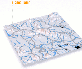 Places with similar names to Làng Vang, Vietnam ::
// Liangfeng (CN)
// Làng Phang (VN)
// Lãng Phong (VN)
// Làng Phung (VN)
// Làng Phương (VN)
// Làng Phương (VN)
// Làng Vướng (VN)
// Làng Vuong (VN)
// Làng Vang (VN)
// Láng Văn Kê (VN)
Disclaimer :: Information on this page comes without warranty of any kind |
||
|
Where is Làng Vang? Elevation and coordinates ::
Latitude (lat): 21°55'0"N Longitude (lon): 105°8'0"E
Elevation (approx.): 51m (map arrows pan, magnifying glasses zoom) |
||
|
Visiting Làng Vang? Hotel/Accommodation ::
Book a hotel in Làng Vang Travel Guide ::
Buy a travel guide for Vietnam rental cars ::
car rental offers GPS waypoint ::
download a GPX waypoint (PoI) of Làng Vang for your GPS receiver
|
||