|
search place name
|
||
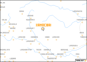
Xã Mộc Bài (Vietnam)Xã Mộc Bài is a town in Vietnam. An overview map of the region around Xã Mộc Bài is displayed below.
regional and 3d topo map of Xã Mộc Bài, Vietnam ::
Xã Mộc Bài airports ::
The nearest airport is DAD - Danang Intl, located 175.8 km south east of Xã Mộc Bài.
Other airports nearby include PKZ - Pakse (203.5 km south west), ZVK - Savannakhet (209.7 km west), Nearby towns ::
Xã Bài (4.1km south east) //
Xóm Bông (5.1km south west) //
Xã Làng Miêt (5.1km south west) //
Làng Suất (5.3km west) //
Ấp La Viên (5.8km south) //
Làng Xóm (6.5km south east) //
Nguốn Rào (6.5km north west) //
Làng Hô (7.7km north west) //
Làng Rươn (7.7km south west) //
[all distances 'as the bird flies' and approximate]  Places with similar names to Xã Mộc Bài, Vietnam ::
// Sama Gaba (ET)
// Simbakbé (CF)
// Somekbe (GH)
// Somqibe (ZW)
// Sumacab (PH)
// Sumucab (PH)
// Xóm Cu (1) (VN)
// Xóm Cu Bó (VN)
// Xóm Gò (1) (VN)
// Smoky Bay (AU)
Disclaimer :: Information on this page comes without warranty of any kind |
||
|
Where is Xã Mộc Bài? Elevation and coordinates ::
Latitude (lat): 16°44'0"N Longitude (lon): 106°43'0"E
Elevation (approx.): 653m (map arrows pan, magnifying glasses zoom) |
||
|
Visiting Xã Mộc Bài? Hotel/Accommodation ::
Book a hotel in Xã Mộc Bài Travel Guide ::
Buy a travel guide for Vietnam rental cars ::
car rental offers GPS waypoint ::
download a GPX waypoint (PoI) of Xã Mộc Bài for your GPS receiver
|
||