|
search place name
|
||
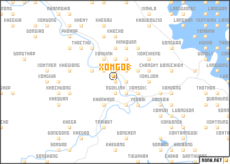
Xóm Gò (1) (Vietnam)Xóm Gò (1) is a town in Vietnam. An overview map of the region around Xóm Gò (1) is displayed below.
regional and 3d topo map of Xóm Gò (1), Vietnam ::
Xóm Gò (1) airports ::
The nearest airport is HAN - Hanoi Noibai Intl, located 115.8 km south east of Xóm Gò (1).
Nearby towns ::
Ngòi Gạo (0.0km north) //
Yên Lương (0.0km north) //
Lò Then (0.0km north) //
Xóm Hàng (1) (0.0km north) //
Ngòi Linh (1.9km south) //
Bài Dương (1.7km east) //
Trấn Yên (1.9km north) //
Gô Ðổng (1.9km north) //
Xóm Giữa (1) (2.5km south east) //
Tuy Lộc (2.5km south east) //
Y Can (2.5km north west) //
Mào Gà (2.5km north east) //
Ðai Ban (3.7km north) //
Phú Mỹ (3.7km north) //
Hai Lương (4.1km south west) //
Khánh Môn (4.1km south west) //
Cầu Phao (4.1km south east) //
Lữ Ðiền (4.1km south east) //
Dao Óc (4.1km south east) //
Xóm Giếng (4.1km south east) //
Ðồng Gianh (3.9km north west) //
Cửa Ngòi (2) (3.9km north west) //
Xóm Soi (2) (3.9km south east) //
Xóm Gùa (4.1km north west) //
Xóm Ðinh (4.1km north west) //
Ðồng Chò (3.9km north east) //
Làng Ðắt (3.9km north east) //
Ðầm Phùng (4.1km north east) //
Yên Bái (5.1km south east) //
[all distances 'as the bird flies' and approximate] 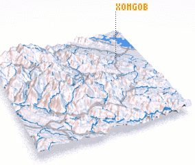 Places with similar names to Xóm Gò (1), Vietnam ::
// Sama Gaba (ET)
// Simbakbé (CF)
// Somekbe (GH)
// Somqibe (ZW)
// Sumacab (PH)
// Sumucab (PH)
// Xã Mộc Bài (VN)
// Xóm Cu (1) (VN)
// Xóm Cu Bó (VN)
// Smoky Bay (AU)
Disclaimer :: Information on this page comes without warranty of any kind |
||
|
Where is Xóm Gò (1)? Elevation and coordinates ::
Latitude (lat): 21°44'0"N Longitude (lon): 104°50'0"E
Elevation (approx.): 55m (map arrows pan, magnifying glasses zoom) |
||
|
Visiting Xóm Gò (1)? Hotel/Accommodation ::
Book a hotel in Xóm Gò (1) Travel Guide ::
Buy a travel guide for Vietnam rental cars ::
car rental offers GPS waypoint ::
download a GPX waypoint (PoI) of Xóm Gò (1) for your GPS receiver
|
||