|
search place name
|
||
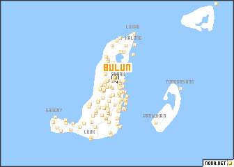
Bulun (Sulu, Philippines)Bulun is a town in the Sulu region of Philippines. An overview map of the region around Bulun is displayed below.
regional and 3d topo map of Bulun, Philippines ::
Bulun airports ::
The nearest airport is ZAM - Zamboanga Intl, located 177.6 km east of Bulun.
Nearby towns ::
Subah (0.5km north east) //
Habuogan (0.5km east) //
Lubak Kawak (0.6km south east) //
Lantong Babag (0.8km north west) //
Parang (0.9km south east) //
Pagsakulan (1.0km south west) //
Segimban (1.0km south east) //
Tubig Lanut (1.2km south west) //
Bangay (1.2km east) //
Dakud Lantong (1.4km west) //
Pangadnan (1.5km south east) //
Tubig Nonok (1.6km south east) //
Dumag (1.7km south) //
Sedapantung (1.7km west) //
Kulid (1.7km west) //
Lubak (1.9km south east) //
Halamon Pababag (1.9km west) //
Kayapuh (1.9km west) //
Tubig Petong (2.0km south) //
Bekud (2.0km south) //
Bandak (2.3km south west) //
Si Ipang (2.3km south west) //
Tubig Sullang (2.4km north west) //
Licud (2.5km west) //
Parian Langgal (2.5km south west) //
Pangutaran (2.6km south east) //
Agal Agal (2.7km south) //
Bual-Bual (2.8km west) //
Bait-Bait (2.9km south east) //
[all distances 'as the bird flies' and approximate] 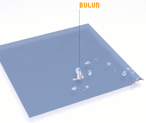 Places with similar names to Bulun, Philippines ::
Disclaimer :: Information on this page comes without warranty of any kind |
||
|
Where is Bulun? Elevation and coordinates ::
Latitude (lat): 6°19'13"N Longitude (lon): 120°34'14"E
Elevation (approx.): 5m (map arrows pan, magnifying glasses zoom) |
||
|
Visiting Bulun? Hotel/Accommodation ::
Book a hotel in Bulun Travel Guide ::
Buy a travel guide for Philippines rental cars ::
car rental offers GPS waypoint ::
download a GPX waypoint (PoI) of Bulun for your GPS receiver
|
||