|
search place name
|
||
Tafraout (Chlef, Algeria)Tafraout is a town in the Chlef region of Algeria. An overview map of the region around Tafraout is displayed below.
regional and 3d topo map of Tafraout, Algeria ::

Tafraout airports ::
The nearest airport is QAS - Ech-cheliff Ech Cheliff, located 20.7 km south of Tafraout.
Other airports nearby include TID - Tiaret Bou Chekif (116.0 km south), ALG - Algier Houari Boumediene (164.6 km east), MUW - Ghriss (173.9 km south west), TAF - Oran Tafaraoui (199.2 km south west), Nearby towns ::
Douar Bou Lalla (1.7km north west) //
Ouled Allal (2.6km south east) //
Tizi Larbaa (2.5km north east) //
Douar Gʼni (2.4km east) //
Douar Cheikh Laraba (3.1km south) //
Oulad el Feki (3.0km west) //
Douar Bou Amoud (3.4km south west) //
Bordi el Mathen (3.6km north west) //
Zeboudja (4.2km south) //
Douar en Nakhla (3.7km north west) //
Douar Tourria (3.7km east) //
El Kharrouba (4.7km north east) //
Douar Zelgou (4.3km west) //
Douar Ouled Brahim (4.9km south east) //
Douar Taksekte (4.8km north west) //
Benaria (5.0km south west) //
Dour el Bruguich (5.4km north west) //
Douar Touadjine (6.4km south) //
Douar Ouled el Hadj (5.9km east) //
Douar Fouat (6.0km west) //
El Mezarea (6.3km west) //
Douar Idouane (7.2km south east) //
Ameraoua (7.7km north west) //
Douar el Mʼrouch (6.9km east) //
Douar Khanouche (7.7km north west) //
Boukaat Laghmount el Bahri (8.5km north) //
Hamlil (7.1km east) //
Douar Chehaïd (7.1km west) //
Douar Charia (8.4km south east) //
[all distances 'as the bird flies' and approximate] 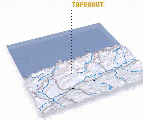 Places with similar names to Tafraout, Algeria ::
Disclaimer :: Information on this page comes without warranty of any kind |
||
|
Where is Tafraout? Elevation and coordinates ::
Latitude (lat): 36°23'9"N Longitude (lon): 1°25'0"E
Elevation (approx.): 731m (map arrows pan, magnifying glasses zoom) |
||
|
Visiting Tafraout? Hotel/Accommodation ::
Book a hotel in Tafraout Travel Guide ::
Buy a travel guide for Algeria rental cars ::
car rental offers GPS waypoint ::
download a GPX waypoint (PoI) of Tafraout for your GPS receiver
|
||