|
search place name
|
||
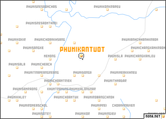
Phumĭ Kântuŏt (Kâmpóng Cham, Cambodia)Phumĭ Kântuŏt is a town in the Kâmpóng Cham region of Cambodia. An overview map of the region around Phumĭ Kântuŏt is displayed below.
regional and 3d topo map of Phumĭ Kântuŏt, Cambodia ::
Phumĭ Kântuŏt airports ::
The nearest airport is SGN - Ho Chi Minh City Tansonnhat Intl, located 123.9 km south of Phumĭ Kântuŏt.
Other airports nearby include PNH - Phnom-penh Phnom Penh Intl (157.3 km west), Nearby towns ::
Phumĭ Tumpôr (2.6km north west) //
Phumĭ Tapuk Leu (2.6km north east) //
Phumĭ Dong (1) (3.7km south) //
Phumĭ Ângkăm (4.1km north west) //
Phumĭ Bŏs Ta Ĕm (4.1km north west) //
Phumĭ Chhuk (4.1km south west) //
Phumĭ Chŏâm Trav (4.1km south west) //
Phumĭ Khchéay (5.2km south east) //
Mémông (7.3km west) //
Phumĭ Kalŏng Nâr (7.4km south) //
Phumĭ Sla (7.3km east) //
Phumĭ Dâmnăk Slêng (7.6km south) //
Phumĭ Chŏâm Triĕk (7.8km south west) //
Phumĭ Ândong Thmâ Cheung (8.3km south west) //
Phumĭ Chŏâm Khsâng (8.1km north west) //
Khŭm Trâmung (9.2km south west) //
Phumĭ Thmâ Dar (9.1km south east) //
Mémót (9.1km south west) //
Phumĭ Krâbas (10.4km north west) //
[all distances 'as the bird flies' and approximate]  Places with similar names to Phumĭ Kântuŏt, Cambodia ::
// Phumĭ Kântuŏt (KH)
// Phumĭ Kântuŏt (KH)
// Phumĭ Kântuŏt (KH)
// Phumĭ Kântuŏt (KH)
// Phumĭ Kântuŏt (KH)
// Phumĭ Kântuŏt (KH)
// Phumĭ Kântuŏt (KH)
// Phumĭ Kântuŏt (KH)
// Phumĭ Kântuŏt (KH)
// Phumĭ Kântuŏt (KH)
Disclaimer :: Information on this page comes without warranty of any kind |
||
|
Where is Phumĭ Kântuŏt? Elevation and coordinates ::
Latitude (lat): 11°52'0"N Longitude (lon): 106°15'0"E
Elevation (approx.): 129m (map arrows pan, magnifying glasses zoom) |
||
|
Visiting Phumĭ Kântuŏt? Hotel/Accommodation ::
Book a hotel in Phumĭ Kântuŏt Travel Guide ::
Buy a travel guide for Cambodia rental cars ::
car rental offers GPS waypoint ::
download a GPX waypoint (PoI) of Phumĭ Kântuŏt for your GPS receiver
|
||