|
search place name
|
||
Phumĭ Tapuk Leu (Kâmpóng Cham, Cambodia)Phumĭ Tapuk Leu is a town in the Kâmpóng Cham region of Cambodia. An overview map of the region around Phumĭ Tapuk Leu is displayed below.
regional and 3d topo map of Phumĭ Tapuk Leu, Cambodia ::

Phumĭ Tapuk Leu airports ::
The nearest airport is SGN - Ho Chi Minh City Tansonnhat Intl, located 125.0 km south of Phumĭ Tapuk Leu.
Other airports nearby include PNH - Phnom-penh Phnom Penh Intl (159.5 km west), Nearby towns ::
Phumĭ Kântuŏt (2.6km south west) //
Phumĭ Tumpôr (3.6km west) //
Phumĭ Bŏs Ta Ĕm (4.1km north west) //
Phumĭ Ângkăm (4.1km north west) //
Phumĭ Sla (5.7km east) //
Phumĭ Khchéay (5.8km south) //
Phumĭ Dong (1) (5.8km south) //
Phumĭ Chŏâm Trav (6.6km south west) //
Phumĭ Chhuk (6.6km south west) //
Phumĭ Thmâ Dar (9.2km south east) //
Phumĭ Meăk Khneu (9.1km south east) //
Phumĭ Chŏâm Triĕk (10.4km south west) //
[all distances 'as the bird flies' and approximate] 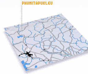 Places with similar names to Phumĭ Tapuk Leu, Cambodia ::
// Phumĭ Toăp Khley (KH)
Disclaimer :: Information on this page comes without warranty of any kind |
||
|
Where is Phumĭ Tapuk Leu? Elevation and coordinates ::
Latitude (lat): 11°53'0"N Longitude (lon): 106°16'0"E
Elevation (approx.): 128m (map arrows pan, magnifying glasses zoom) |
||
|
Visiting Phumĭ Tapuk Leu? Hotel/Accommodation ::
Book a hotel in Phumĭ Tapuk Leu Travel Guide ::
Buy a travel guide for Cambodia rental cars ::
car rental offers GPS waypoint ::
download a GPX waypoint (PoI) of Phumĭ Tapuk Leu for your GPS receiver
|
||