|
search place name
|
||
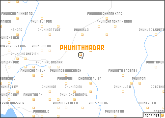
Phumĭ Thmâ Dar (Kâmpóng Cham, Cambodia)Phumĭ Thmâ Dar is a town in the Kâmpóng Cham region of Cambodia. An overview map of the region around Phumĭ Thmâ Dar is displayed below.
regional and 3d topo map of Phumĭ Thmâ Dar, Cambodia ::
Phumĭ Thmâ Dar airports ::
The nearest airport is SGN - Ho Chi Minh City Tansonnhat Intl, located 116.3 km south of Phumĭ Thmâ Dar.
Other airports nearby include PNH - Phnom-penh Phnom Penh Intl (163.3 km west), Nearby towns ::
Phumĭ Meăk Khneu (2.6km north east) //
Phumĭ Khchéay (4.1km north west) //
Phumĭ Rôbâng Chrŏh (5.2km south west) //
Phumĭ Sla (5.6km north) //
Chŏâm Krâviĕn (5.8km south) //
Phumĭ Dâmnăk Slêng (5.7km west) //
Phumĭ Bânghaeuy Huŏs (6.6km south west) //
Phumĭ Prei (6.6km south west) //
Phumĭ Dong (1) (7.5km west) //
Phumĭ Dong (7.6km south) //
Phumĭ Kalŏng Nâr (7.5km west) //
Phumĭ Ngiĕv (7.6km south) //
Phumĭ Chângkâm Leu (7.8km north east) //
Kdŏl Kraôm (8.3km north east) //
Phumĭ Tapuk Leu (9.2km north west) //
Phumĭ Kântuŏt (9.1km north west) //
Phumĭ Chângkâm Kraôm (10.4km north east) //
Phumĭ Kôr (10.4km south west) //
[all distances 'as the bird flies' and approximate] 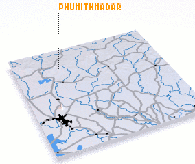 Places with similar names to Phumĭ Thmâ Dar, Cambodia :: Disclaimer :: Information on this page comes without warranty of any kind |
||
|
Where is Phumĭ Thmâ Dar? Elevation and coordinates ::
Latitude (lat): 11°49'0"N Longitude (lon): 106°19'0"E
Elevation (approx.): 143m (map arrows pan, magnifying glasses zoom) |
||
|
Visiting Phumĭ Thmâ Dar? Hotel/Accommodation ::
Book a hotel in Phumĭ Thmâ Dar Travel Guide ::
Buy a travel guide for Cambodia rental cars ::
car rental offers GPS waypoint ::
download a GPX waypoint (PoI) of Phumĭ Thmâ Dar for your GPS receiver
|
||