|
search place name
|
||
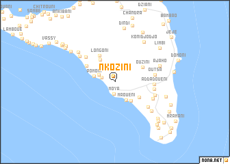
Nkozini (Anjouan, Comoros)Nkozini is a town in the Anjouan region of Comoros. An overview map of the region around Nkozini is displayed below.
regional and 3d topo map of Nkozini, Comoros ::
Nkozini airports ::
The nearest airport is AJN - Anjouan Ouani, located 17.4 km north of Nkozini.
Other airports nearby include NWA - Moheli Bandaressalam (73.2 km west), DZA - Dzaoudzi Pamandzi (107.8 km south east), HAH - Moroni Prince Said Ibrahim (152.2 km north west), Nearby towns ::
Moya (2.0km south) //
Koué (2.3km west) //
Magnassini-Nindri (2.8km north west) //
Maouéni (3.4km south east) //
Pomoni (3.5km west) //
Chindrini (4.0km south east) //
Lingoni (4.3km north west) //
Kangani (4.6km south east) //
Longoni (5.0km north west) //
Ouzini (5.0km north east) //
Hamamboua (5.2km north west) //
Choungoui (6.2km north west) //
Adda-Douéni (6.3km east) //
Jandza (6.4km east) //
Outsa (6.4km east) //
Bandakouni (6.7km south east) //
Daji (6.7km south east) //
Mrémani (6.8km east) //
Dar Salam (7.0km north west) //
Mrijou (7.5km south east) //
Bandani-Vouani (7.6km north west) //
Ajaho (7.6km east) //
Koni-Djodjo (8.0km north east) //
Ongoujou (8.4km east) //
Vouani (8.6km north west) //
Dindi (8.9km north) //
Limbi (9.0km north east) //
Mnazichoumoué (9.0km south east) //
Koni-Ngani (9.2km north east) //
[all distances 'as the bird flies' and approximate]  Places with similar names to Nkozini, Comoros ::
// Ngasin (MM)
// Ngazane (MM)
// Ngazun (MM)
// Ngosin (MM)
// Nixon (US)
// Nixon (US)
// Néa Kesáni (GR)
// Gniewczyna (PL)
// Niczonów (PL)
// Niegocin (PL)
Disclaimer :: Information on this page comes without warranty of any kind |
||
|
Where is Nkozini? Elevation and coordinates ::
Latitude (lat): 12°17'20"S Longitude (lon): 44°26'22"E
Elevation (approx.): 357m (map arrows pan, magnifying glasses zoom) |
||
|
Visiting Nkozini? Hotel/Accommodation ::
Book a hotel in Nkozini Travel Guide ::
Buy a travel guide for Comoros rental cars ::
car rental offers GPS waypoint ::
download a GPX waypoint (PoI) of Nkozini for your GPS receiver
|
||