|
search place name
|
||
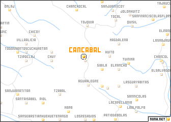
Cancábal (Huehuetenango, Guatemala)Cancábal is a town in the Huehuetenango region of Guatemala. An overview map of the region around Cancábal is displayed below.
regional and 3d topo map of Cancábal, Guatemala ::
Cancábal airports ::
The nearest airport is CBV - Coban, located 117.4 km east of Cancábal.
Other airports nearby include TAP - Tapachula Intl (121.8 km south west), GUA - Guatemala City La Aurora (145.7 km south east), TGZ - Tuxtla Gutierrez Angel Albino Corzo (201.2 km north west), Nearby towns ::
El Rosario (0.0km north) //
Sibilá (4.0km south east) //
Agua Alegre (5.3km south) //
Huito (5.2km east) //
San Antonio Las Nubes (6.6km south east) //
Chuy (7.1km west) //
El Rancho (7.4km east) //
El Rancho (7.4km west) //
Tojquiá (7.7km north) //
Páquix (7.7km south east) //
Magdalena (8.0km north east) //
Tzábal (9.1km south west) //
Ixquiac (9.1km south east) //
[all distances 'as the bird flies' and approximate] 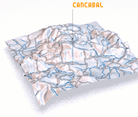 Places with similar names to Cancábal, Guatemala ::
// Concabella (ES)
// Kinkubala (CD)
// Cancábal (GT)
// Kancabal (MX)
// Kangabala (ZM)
// Guangabal (PE)
// Koingbélo (GN)
// Kankböle (FI)
// Quenquibol (PH)
// Gongabli (LR)
Disclaimer :: Information on this page comes without warranty of any kind |
||
|
Where is Cancábal? Elevation and coordinates ::
Latitude (lat): 15°30'0"N Longitude (lon): 91°30'0"W
Elevation (approx.): 3470m (map arrows pan, magnifying glasses zoom) |
||
|
Visiting Cancábal? Hotel/Accommodation ::
Book a hotel in Cancábal Travel Guide ::
Buy a travel guide for Guatemala rental cars ::
car rental offers GPS waypoint ::
download a GPX waypoint (PoI) of Cancábal for your GPS receiver
|
||