|
search place name
|
||
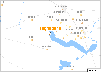
Bāqargarh (Delhi, India)Bāqargarh is a town in the Delhi region of India. An overview map of the region around Bāqargarh is displayed below.
regional and 3d topo map of Bāqargarh, India ::
Bāqargarh airports ::
The nearest airport is DEL - Delhi Indira Gandhi Intl, located 22.2 km east of Bāqargarh.
Other airports nearby include AGR - Agra (191.9 km south east), DED - Dehra Dun Dehradun (217.2 km north east), JAI - Jaipur (222.7 km south west), Nearby towns ::
Mandhela Kalān (2.6km north east) //
Mandhela Khurd (2.7km north east) //
Jāfarpur Kalān (4.3km east) //
Dhandāsa (5.2km south) //
Kair (5.1km north east) //
Saulda (5.9km north) //
Lowah Kalān (5.9km north east) //
Soreda (5.8km east) //
Bādli (6.2km west) //
Isharheri (6.8km north east) //
Mitrāon (6.8km east) //
Surkhpur (7.2km north east) //
Nayāgaon (8.3km north) //
Bupania (8.5km north west) //
Jharoda Kalān (9.7km north east) //
[all distances 'as the bird flies' and approximate] 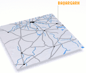 Places with similar names to Bāqargarh, India ::
// Bakragara (IQ)
// Böğrüeğri (TR)
// Boukari Koyré (NE)
// Bakorokoro (GN)
// Bugaragara (RW)
// Bagargar (NG)
// Bakarkura (NG)
// Bakroukro (CI)
Disclaimer :: Information on this page comes without warranty of any kind |
||
|
Where is Bāqargarh? Elevation and coordinates ::
Latitude (lat): 28°35'45"N Longitude (lon): 76°52'43"E
Elevation (approx.): 214m (map arrows pan, magnifying glasses zoom) |
||
|
Visiting Bāqargarh? Hotel/Accommodation ::
Book a hotel in Bāqargarh Travel Guide ::
Buy a travel guide for India rental cars ::
car rental offers GPS waypoint ::
download a GPX waypoint (PoI) of Bāqargarh for your GPS receiver
|
||