|
search place name
|
||
Bakorokoro (Beyla, Guinea)Bakorokoro is a town in the Beyla region of Guinea. An overview map of the region around Bakorokoro is displayed below.
regional and 3d topo map of Bakorokoro, Guinea ::

Bakorokoro airports ::
The nearest airport is MJC - Man, located 107.2 km south east of Bakorokoro.
Other airports nearby include DJO - Daloa (227.2 km south east), Nearby towns ::
Morigbadougou (1.9km north) //
Zingouédougou (2.6km south east) //
Salou (4.1km south east) //
Douroufé (4.1km south west) //
Diakama (5.2km south east) //
Ouorono (5.2km north east) //
Sayodougou (5.2km south west) //
Foumbédougou (5.2km north west) //
Sokwara (5.5km east) //
Gondodougou (5.9km south) //
Tiémaso (7.4km north) //
Siakoro (7.6km north) //
Yanvanou (7.6km north) //
Guéoué (8.2km south west) //
Paléféso (9.2km north west) //
Nialeu (9.2km north west) //
Fogodougou (10.4km south west) //
[all distances 'as the bird flies' and approximate] 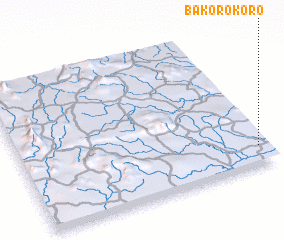 Places with similar names to Bakorokoro, Guinea ::
// Bakragara (IQ)
// Böğrüeğri (TR)
// Bāqargarh (IN)
// Boukari Koyré (NE)
// Bugaragara (RW)
// Bagargar (NG)
// Bakarkura (NG)
// Bakroukro (CI)
Disclaimer :: Information on this page comes without warranty of any kind |
||
|
Where is Bakorokoro? Elevation and coordinates ::
Latitude (lat): 8°8'0"N Longitude (lon): 8°2'0"W
Elevation (approx.): 500m (map arrows pan, magnifying glasses zoom) |
||
|
Visiting Bakorokoro? Hotel/Accommodation ::
Book a hotel in Bakorokoro Travel Guide ::
Buy a travel guide for Guinea rental cars ::
car rental offers GPS waypoint ::
download a GPX waypoint (PoI) of Bakorokoro for your GPS receiver
|
||