|
search place name
|
||
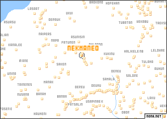
Nekmaneo (Nusa Tenggara Timur, Indonesia)Nekmaneo is a town in the Nusa Tenggara Timur region of Indonesia. An overview map of the region around Nekmaneo is displayed below.
regional and 3d topo map of Nekmaneo, Indonesia ::
Nekmaneo airports ::
The nearest airport is DIL - Dili Presidente Nicolau Lobato Intl, located 112.2 km north east of Nekmaneo.
Nearby towns ::
Nismanu (0.3km north east) //
Manumean (0.3km north) //
Unbaen (0.4km south) //
Besasu (0.8km south east) //
Makun (1.0km south east) //
Oetimu (1.4km south east) //
Aklirun (1.4km north) //
Haobesi (1.9km south east) //
Oeruin (2.3km north west) //
Nularan (3.7km north east) //
Haliran (3.8km north east) //
Birunatun (3.9km north east) //
Asunisin (4.1km north) //
Fatunabo (4.0km east) //
Faturen (4.2km north west) //
Oemanu (4.4km south west) //
Oetowe (4.4km west) //
Fatunapi (4.6km south west) //
Oetfo (4.7km south west) //
Saken (5.2km south west) //
Bausari (5.3km east) //
Oebone (5.9km south west) //
Kukinu (5.9km east) //
Patukabia (6.2km west) //
Halibeseka (6.3km east) //
Tupun (6.8km south west) //
Upsean (6.8km west) //
Napa (6.9km north west) //
Oereu (7.3km south) //
[all distances 'as the bird flies' and approximate] 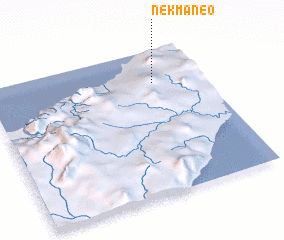 Places with similar names to Nekmaneo, Indonesia ::
// Ngamin (MM)
// Ngomuin (CM)
// Ngomban (CM)
// Nowy Kamień (PL)
// Na Kamenu (BA)
// Nkambeni (ZA)
// Ngomani II (TD)
// Ngambon (ID)
// Nikoman (MK)
// Ngombani (KE)
Disclaimer :: Information on this page comes without warranty of any kind |
||
|
Where is Nekmaneo? Elevation and coordinates ::
Latitude (lat): 9°13'39"S Longitude (lon): 124°46'8"E
Elevation (approx.): 456m (map arrows pan, magnifying glasses zoom) |
||
|
Visiting Nekmaneo? Hotel/Accommodation ::
Book a hotel in Nekmaneo Travel Guide ::
Buy a travel guide for Indonesia rental cars ::
car rental offers GPS waypoint ::
download a GPX waypoint (PoI) of Nekmaneo for your GPS receiver
|
||