|
search place name
|
||
Palo Dulce (México, Mexico)Palo Dulce is a town in the México region of Mexico. An overview map of the region around Palo Dulce is displayed below.
regional and 3d topo map of Palo Dulce, Mexico ::

Palo Dulce airports ::
The nearest airport is CVJ - Cuernavaca General Mariano Matamoros, located 21.8 km east of Palo Dulce.
Other airports nearby include TLC - Toluca Licenciado Adolfo Lopez Mateos Intl (54.0 km north), MEX - Mexico City Licenciado Benito Juarez Intl (76.3 km north east), PBC - Puebla Hermanos Serdan Intl (120.0 km east), PCA - Pachuca Ingeniero Juan Guillermo Villasana (152.8 km north east), Nearby towns ::
San Pedro Chichicasco (1.0km south west) //
Tepehuajes (2.0km south east) //
Los Tepehuajes (2.0km north east) //
La Lagunita (2.6km north east) //
Platanar (3.3km south east) //
Amate Amarillo (4.1km north west) //
Agua Bendita (4.5km north east) //
Puente Caporal (5.0km north) //
Noxtepec Zaragoza (5.4km south) //
La Maromar (5.4km south) //
Palpán (5.3km east) //
Puente (5.8km north east) //
Monte Grande (5.7km north west) //
Hidalgo (6.5km south) //
Pueblo Nuevo (6.5km north) //
El Puentecito (6.5km north) //
Santa María Xoquia (6.6km south west) //
Juárez (6.7km south) //
La Ladrillera (6.7km north) //
Ahuatzingo (7.4km south west) //
Xalmolonco (7.4km north west) //
Tlajotla (7.1km east) //
Chalma (7.4km north east) //
Palo Grande (7.5km east) //
Santa Cruz Atempa (8.4km south west) //
San Pedro Guadalupe (8.7km south west) //
San Martín (9.0km north west) //
Palmar de Guadalupe (9.0km north west) //
[all distances 'as the bird flies' and approximate] 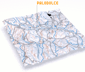 Places with similar names to Palo Dulce, Mexico ::
// Paletillas (EC)
// Palo Dulce (MX)
// Palo Dulce (MX)
// Palo Dulce (MX)
// Palo Dulce (MX)
// Palo Dulce (MX)
// Palo Dulce (MX)
// Paletales (HN)
// Paletillas (PE)
// Platillos (PE)
Disclaimer :: Information on this page comes without warranty of any kind |
||
|
Where is Palo Dulce? Elevation and coordinates ::
Latitude (lat): 18°51'30"N Longitude (lon): 99°28'0"W
Elevation (approx.): 1319m (map arrows pan, magnifying glasses zoom) |
||
|
Visiting Palo Dulce? Hotel/Accommodation ::
Book a hotel in Palo Dulce Travel Guide ::
Buy a travel guide for Mexico rental cars ::
car rental offers GPS waypoint ::
download a GPX waypoint (PoI) of Palo Dulce for your GPS receiver
|
||