|
search place name
|
||
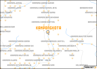
Kampong Kota (Kedah, Malaysia)Kampong Kota is a town in the Kedah region of Malaysia. An overview map of the region around Kampong Kota is displayed below.
regional and 3d topo map of Kampong Kota, Malaysia ::
Kampong Kota airports ::
The nearest airport is AOR - Alor Setar Sultan Abdul Halim, located 73.8 km north west of Kampong Kota.
Other airports nearby include PEN - Penang Intl (85.3 km south west), PAN - Pattani (117.9 km north), NAW - Narathiwat (126.3 km north east), IPH - Ipoh Sultan Azlan Shah (132.4 km south), Nearby towns ::
Kampung Terabak (0.0km north) //
Kampong Tandok (1.9km south) //
Kampong Bendang Darat (1.9km south) //
Kampong Sungai Siput (1.9km north) //
Kampong Dusun Gani (1.9km south) //
Kampong Tanjong Paus (1.9km south) //
Kampong Paya (1.9km north) //
Kampong Bukit Payong (1.9km south) //
Kampong Benchah Tualang (2.6km north east) //
Kampong Siput (2.6km north west) //
Kampong Telok Temelah (3.7km east) //
Kampong Luar (3.7km north) //
Kampong Baharu (3.7km north) //
Kampong Pandai Saad (3.7km south) //
Kampong Berangan (3.7km north) //
Kampong Siong (3.7km north) //
Kampong Banggol Leban (3.7km south) //
Kampong Lahar (4.1km south east) //
Kampong Banggol Sentol (4.1km south east) //
Kampong Charok Bunting (4.1km north west) //
Kampong Wat (4.1km north west) //
Kampong Kelian Dalam (4.1km north west) //
Kampong Telok Sungai Durian (5.2km south east) //
Kampong Lalang (5.6km north) //
Kampong Benchah Sawa (5.6km north) //
Kampong Bakar Bata (5.9km south) //
Kampong Masjid (5.9km south) //
Kampong Nering (5.9km south) //
Kampong Padang Temu (5.9km south) //
[all distances 'as the bird flies' and approximate] 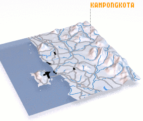 Places with similar names to Kampong Kota, Malaysia ::
// Kampong Kut (MY)
// Kampong Aiketu (TH)
// Kampong Kota (TH)
// Kampong Koto (TH)
// Kâmpóng Kdei (KH)
// Kampong Kaid (MY)
// Kampong Kedah (MY)
// Kampong Kedah (MY)
// Kampong Kedah (MY)
// Kampong Kedah (MY)
Disclaimer :: Information on this page comes without warranty of any kind |
||
|
Where is Kampong Kota? Elevation and coordinates ::
Latitude (lat): 5°45'0"N Longitude (lon): 100°54'0"E
Elevation (approx.): 103m (map arrows pan, magnifying glasses zoom) |
||
|
Visiting Kampong Kota? Hotel/Accommodation ::
Book a hotel in Kampong Kota Travel Guide ::
Buy a travel guide for Malaysia rental cars ::
car rental offers GPS waypoint ::
download a GPX waypoint (PoI) of Kampong Kota for your GPS receiver
|
||