|
search place name
|
||
Kampong Kota Lama Kanan (Perak, Malaysia)Kampong Kota Lama Kanan is a town in the Perak region of Malaysia. An overview map of the region around Kampong Kota Lama Kanan is displayed below.
regional and 3d topo map of Kampong Kota Lama Kanan, Malaysia ::

Kampong Kota Lama Kanan airports ::
The nearest airport is IPH - Ipoh Sultan Azlan Shah, located 27.6 km south east of Kampong Kota Lama Kanan.
Other airports nearby include PEN - Penang Intl (95.3 km north west), AOR - Alor Setar Sultan Abdul Halim (167.8 km north), NAW - Narathiwat (210.4 km north east), KBR - Kota Bahru Sultan Ismail Petra (212.2 km north east), Nearby towns ::
Kampong Kapala Bendang (0.0km north) //
Kampong Pauh (0.0km north) //
Kampong Lembah (1.9km south) //
Kampong Bendang Kering (1.9km south) //
Kampong Padang Petai (1.9km north) //
Kampong Pasir Batang Kulim (1.9km north) //
Kampong Sayong (1.8km west) //
Kampong Penaga (1.8km west) //
Kampong Kandang (1.8km west) //
Kampong Jias (1.8km west) //
Kampong Pasong (1.8km west) //
Kampong Parit (1.8km west) //
Kampong Jenalik (2.6km south west) //
Kampong Tambang (2.6km south west) //
Kampong Keledang (2.6km north west) //
Kampong Mesjid (2.6km north west) //
Kampong Chermin (3.7km south) //
Kampong Padang Changkat (3.7km south) //
Kampong Batang Kulim (3.7km north) //
Kampong Kuala Chempelas (3.7km west) //
Kampong Lasin (3.7km west) //
Kampong Senawar (4.1km south west) //
Kampong Sungai Siput (4.1km south west) //
Kuala Kangsar (4.1km south west) //
Kampong Keledang Kiri (4.1km north west) //
Kampong Beluru (4.1km north west) //
Kampong Punti (4.1km north west) //
Kampong Jamuan (4.1km north west) //
Kampong Java (5.2km south west) //
[all distances 'as the bird flies' and approximate] 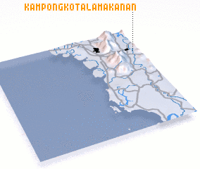 Places with similar names to Kampong Kota Lama Kanan, Malaysia :: Disclaimer :: Information on this page comes without warranty of any kind |
||
|
Where is Kampong Kota Lama Kanan? Elevation and coordinates ::
Latitude (lat): 4°47'0"N Longitude (lon): 100°58'0"E
Elevation (approx.): 52m (map arrows pan, magnifying glasses zoom) |
||
|
Visiting Kampong Kota Lama Kanan? Hotel/Accommodation ::
Book a hotel in Kampong Kota Lama Kanan Travel Guide ::
Buy a travel guide for Malaysia rental cars ::
car rental offers GPS waypoint ::
download a GPX waypoint (PoI) of Kampong Kota Lama Kanan for your GPS receiver
|
||